|
WHILE THE TWO VIRGINIAS WERE
ONE, 1750-1861.
Geography of West
Virginia.
HE State of West Virginia
has the most irregular outline of all the American states. It is situated
between 30°6' and 40°30' north latitude, and between 0°40' and 5°55'
longitude west from Washington, or 77°40' and 82°55' from Greenwich. The
area is 24,715 square miles. This is almost twenty times that of Rhode
Island, twelve times that of Delaware, five times that of Connecticut,
three times that of Massachusetts, and more than twice that of Maryland.
The state embraces four distinct physical regions or sections: (1) the
Ohio Valley Region; (2) the Cumberland Plateau; (3) the Allegheny
Highland, and (4) the Potomac Region. The boundaries of each are well
known to those who have given attention to the topography of the state.
There are fifty-five counties, and with the exception of two - Berkeley
and Jefferson - on the upper Potomac, or in the Lower Shenandoah Valley,
and six others - Morgan, Hampshire, Mineral, Hardy, Grant and Pendleton -
all lie in the Trans-Allegheny Region and are drained by northwestward
flowing rivers into the Ohio. Here, amid these hills and mountains, white
men have made nearly two centuries of civil and military history.
Early Explorations.
All over the state are the
evidences of the existence of a people now long gone. These consist of
mounds which dot the landscape, and implements, weapons and ornaments
scattered over the surface or upturned by the plowshare. They are
interesting to the antiquarian, but have no place in history, for neither
in blood, manners, speech nor law, have these people left a mark in all
the land in which they lived. The Indian occupation of this region is an
interesting topic. A band of Mohegans was on the Kanawha River in 1670;
still later the Conoys or Kanawhas, whose name has been given to this
river, were on its upper tributaries ; the Cherokees claimed that portion
of the state lying south of the Great Kanawha; the Shawnees were living on
the Upper Potomac and along the South Branch of that river in the first
half of the Eighteenth century; the Delawares lingered in the valley of
the Monongahela as late as 1763, while bands of Mingoes, Wyandotts and
Miamis roamed over the whole extent of the state as a common hunting
ground.
West Virginia was not
included in the first grant made by King James I., in 1606, to the
Virginia Company of London. It was, however, included in its chartered
limits in 1609, and thus the state became a part of Virginia when the
infant colony at Jamestown had existed but two years. It became a land of
discovery and exploration. The first West Virginia river known to white
men is called New River ; it was discovered in 1641-2 by Walter Austin,
Rice Hoe, and their associates. In 1670 John Lederer, a German explorer in
the service of Sir William Berkeley, in company with a Captain Collett and
nine Englishmen, left the York River, passed the source of the
Rappahannock, and from the crest of the Blue Ridge, near what is now
Harper's Ferry, looked down upon the Lower Shenandoah Valley, beyond which
they beheld in the distance, standing like a towering wall, the Great
North Mountain and other summits, in what is now Berkeley and Morgan
counties, in West Virginia. The same year Governor Berkeley issued to
General Abram Wood, a commission "for ye finding out of ye ebbing and
flowing of ye water on ye other side of ye mountains." Under this
authority he, the next year, sent out a party of five persons under the
command of Captain Thomas Batts for this purpose. They left the site of
the present city of Petersburg, on the Appomattox River, journeyed
westward to the Blue Ridge, which mountain barrier they crossed, and
descended into what is now Monroe county, West Virginia. Pressing onward
they beheld the high cliff walls of the canons of New River, and on the
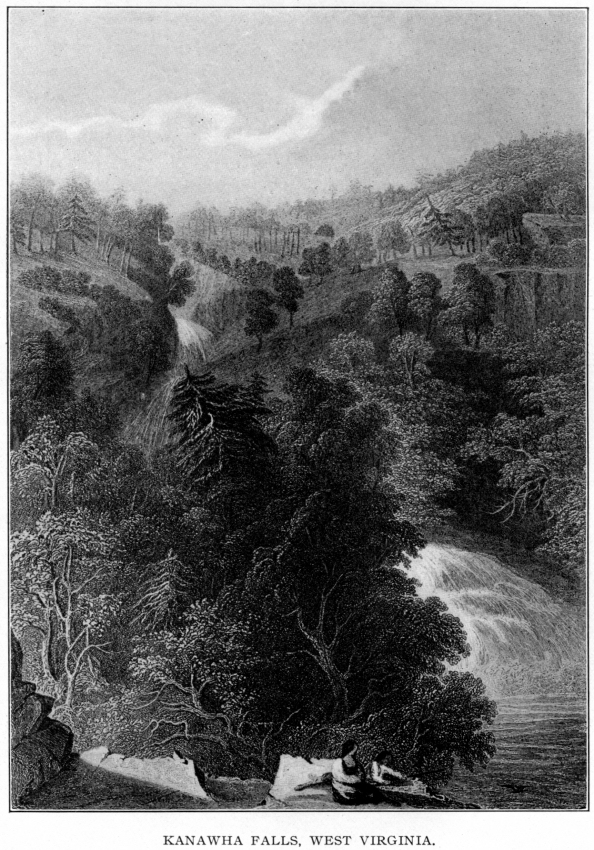
evening of Sept. 16, 1671, they reached the falls of the Great Kanawha,
where they "had a sight of a curious river, like the Thames at Chelsea,
but had a fall that made a great noise." The next day they took possession
of the valley of this river for the King in these words: "Long live
Charles ye 2d, by the Grace of God, King of England, Scotland, France,
Ireland, Virginia and of all the Territories thereto belonging." Then they
set up a stick by the water-side to ascertain the ebb and flow; marked
some trees, and discharged fire-arms, after which they began the homeward
march. Such was the discovery of Kanawha Falls 237 years ago. Forty-five
years thereafter, Alexander Spottswood, lieutenant-governor of Virginia,
became interested in exploration to the westward of the Blue Ridge.
Equipping a party of thirty horsemen and heading it in person, the
cavalcade left Williamsburg and journeyed onward through the Piedmont
Region, passed the "great divide," by way of Swift Gap, and descended to a
river now known by the name of Shenandoah, but to which the explorers gave
that of "Euphrates "-the first Christian name bestowed upon a West
Virginia river. Far away to the westward they beheld the mountain peaks,
around the "Birth-Place of Rivers," in West Virginia. Such was the origin
of the "Knights of the Golden Horse-Shoe," a title bestowed by Spottswood
upon those who accompanied him.
Settlements Before 1754.
The first quarter of the
Eighteenth century passed away, and all this region remained a primeval
wilderness; but the time was near at hand when white men should come to
occupy the land. In 1725 John Van Meter, an Indian trader from the Hudson
River, traversed the Lower Shenandoah, Upper Potomac and South Branch
Valleys, but the honor of fixing the first permanent home of civilized men
in West Virginia was reserved to another. This was Morgan Morgan, who, in
1726-7, reared his home on the site of the present village of Bunker Hill,
in what is now Mill Creek magisterial district, in Berkeley county. He was
a native of Wales who came early in life to Pennsylvania, and thence to
the Shenandoah Valley. He was soon followed by some German people from
that colony whose ancestral home was Mecklenburg in the Fatherland; they
crossed the Potomac at the "Old Pack-Horse Ford" in 1727, and a mile
above, on its southern bank, among the masses of gray limestone everywhere
visible, they laid the foundation of a village which they called New
Mecklenburg. This is now Shepherdstown, the oldest town in West Virginia.
Soon after Richard Morgan obtained a grant for a tract of land near
Mecklenburg, where he made his home. Among those who came about 1734 and
found homes along the Potomac River, in what are the present counties of
Berkeley and Jefferson, were Robert Harper (at Harper's Ferry), William
Stroop, Thomas and William Forester, Van Swearingen, James Foreman, Edward
Lucas, Jacob Hite, Jacob Lemon, Richard Mercer, Edward Mercer, Jacob Van
Meter, Robert Stockton, Robert Buckles, John Taylor, Samuel Taylor and
John Wright. In 1735 the first settlement was made in the valley of the
South Branch of the Potomac, in what is now Hampshire county, by four
families of the names of Cobun, Howard, Walker and Rutledge. A year
thereafter Isaac Van Meter, Peter Casey, the Pancakes, Foremans and others
reared homes further up the South Branch, some of them within what is now
Hardy county.
A land grant which played
an important part in the early settlement of West Virginia was that known
as the "Lord Fairfax Patent." In 1681 - forty-five years before a white
man found a home in West Virginia-King Charles II. issued letters patent
to Ralph Hopton; Henry, Earl of St. Albans; John, Lord Culpeper; John,
Lord Berkeley; Sir William Morton, Sir Dudley Wyatt and Thomas Culpeper,
their heirs and assigns forever for all the lands situated between the
rivers Rappahannock and Potomac, and bounded by the courses of these
rivers. Years passed away; the proprietors died, and the vast estate
descended to the sixth Lord, Thomas Fairfax, who had wedded Margaret, the
only child of Lord Culpeper. At the time of the original grant nothing was
thought of its extent west of the Blue Ridge, but as the region drained by
the upper tributary streams of the Potomac became known, it was seen that
a large portion of it would be included within the limits of this grant.
Commissioners were therefore appointed - three by the King, and three by
Lord Fairfax - to determine its boundaries. There were delays, but on Oct.
17, 1746, the "Fairfax Stone" was erected at the source, or first
fountain, of the North Branch of the Potomac; thence a line was afterward
run to the source of the Rappahannock, the present West Virginia counties,
within the grant being the whole of Jefferson, Berkeley, Morgan,
Hampshire, Mineral, nine-tenths of Hardy, three-fourths of Grant and
one-eighth of Tucker-an area of 2,540 square miles, or 1,625,600 acres. In
1747 Lord Fairfax employed the boy surveyor, George Washington, to lay off
portions of these lands to suit settlers then arriving, and in this, and
the two ensuing years, nearly 300 tracts were surveyed. Thus it was that
George Washington, who led the American armies in the Revolution, and who
was the first President of the United States, surveyed the first farms in
West Virginia. Settlements were formed far up the South Branch of the
Potomac, even into what is now Pendleton county, and daring frontiersmen
sought homes beyond the mountains to the westward. In 1753 David Tygart
and Robert Foyle settled on what is since known as Tygart's Valley River,
now in Randolph county. The next year Thomas Eckarly and two brothers
reared a cabin on Dunkard's Bottom on Cheat River, now in Preston county,
and three years later Thomas Decker and others began a settlement at the
mouth of what has since been known as Decker's Creek, on the Monongahela
River, where Morgantown, in Monongalia county, now stands.
Another land grant played
an important part in the early settlement of West Virginia. It was for
100,000 acres in the Greenbrier Valley, made in 1749 to the "Greenbrier
Land Company," which consisted of twelve members, among whom were its
president, John Robinson, treasurer of the colony of Virginia; Thomas
Nelson, for thirty years secretary of the Council of State, and John
Lewis, the founder of Staunton, and two of his sons. Four years were
allowed for surveys and settlements. Andrew Lewis, afterward General
Andrew Lewis of the Revolution, was appointed surveyor for the company ;
he hastened the work, and Col. John Stuart, the historian of the
Greenbrier Valley, states that prior to 1755 Lewis had surveyed settlement
rights aggregating more than 50,000 acres. Thus civilized men found homes
in the Greenbrier Valley. The settlements in the wilds of Augusta county
were formed in 1738, and by an act of the House of Burgesses in 1753,
Hampshire county, embracing all the settlements on the upper waters of the
Potomac, and the first unit of civil government in West Virginia, was
created. In 1756 Captain Teague sent to the Lords of Trade and
Plantations, London, a "List of Tithables" on which was based a census of
Virginia. Taking his estimate it appears that at this time there were
about 10,000 whites and 400 blacks within the present limits of West
Virginia.
If an irregular line be
drawn from the Blue Ridge through Harper's Ferry and Charles Town in
Jefferson county, Martinsburg in Berkeley county, Berkeley Springs in
Morgan county, Romney in Hampshire county, Moorefield in Hardy county,
Petersburg in Grant county, Upper Tract and Franklin in Pendleton county,
Marlinton in Pocahontas county, thence down Greenbrier River through
Greenbrier county, and thence through Monroe county to Peter's Mountain,
it will pass centrally through the region in which resided the pioneer
settlers of West Virginia at that time.
Wars with Indians.
From the time of the coming
of the first settler to the state to the year 1754, white men and Indians
had lived together in peace and harmony. But now the old French and Indian
War-the final struggle between the French and English for territorial
supremacy in America-was at hand, and barbarian warfare was to desolate
the West Virginia settlements. The colonial government of Virginia, at the
head of which was the lieutenant-governor, Robert Dinwiddie, hastened
preparations for defense. Col. George Washington, with the First Virginia
Regiment, was sent to the West Virginia frontier. Forts for defensive and
offensive operations were speedily erected. Fort Ashby stood on the east
bank of Patterson's Creek, in what is now Frankfort district, Mineral
county; Fort Waggener was on the South Branch of the Potomac, three miles
above the site of Moorefield, in Hardy county ; Fort Capon was at Forks of
Capon, now in Bloomery district, in Hampshire county; Fort Cox stood on
the lower point of land at the confluence of the Little Cacapon and
Potomac rivers ; Fort Edwards was near the site of Capon Bridge, now in
Bloomery district, Hampshire county; Fort Evans was two miles south of
where Martinsburg, in Arden district, Berkeley county, now stands; Fort
Ohio stood where the village of Ridgeley, in Frankfort district, Mineral
county, is now situated ; Fort Pearsall was on the site of the present
town of Romney, in Hampshire county; Fort Peterson was on the South Branch
of the Potomac, in Milroy district, Grant county; Fort Pleasant was
erected on the Indian Old Fields, now in Hardy county; Fort Riddle was in
Lost River district, Hardy county; Fort Sellers was at the mouth of
Patterson's Creek, now in Frankfort district, Mineral county; Fort Upper
Tract was in what is now Mill Run district, Pendleton county, and Fort
Seybert stood on the bank of the South Fork of the South Branch of the
Potomac in the same county.
The French, with their
savage allies, bore down with resistless fury upon the West Virginia
border, and around these primitive forts were enacted many of the
tragedies and dramas of the wilderness. The Tygart and Foyle_ settlements
on Tygart's Valley River, together with those of the Eckarlys on Cheat
River, and of the Deckers on the Monongahela, were destroyed, and many
persons killed on Greenbrier River. Fierce battles were waged in the
vicinity of Fort Edwards, Fort Riddle and Fort Pleasant; bloody massacres
occurred at Fort Upper Tract and Fort Seybert, and many a West Virginia
family became victims of savage barbarity. After seven years of war,
hostilities were ended; then came the conspiracy of Pontiac in 1763, and
with it the Muddy Creek massacre in the Greenbrier Valley, in which the
entire settlement was destroyed by a band of Shawnee Indians.
Settlements 1760-1776.
Now for a time the Indian
wars were ended, and what is known as "the halcyon decade of the
Eighteenth century' -1763-1773-was ushered in. Daring pioneers sought
homes west of the mountains; James Moss reared his cabin home at the Sweet
Springs, now in Monroe county, in 1760; Archibald Clendenin and Felta
Youcom, on Greenbrier River, in 1761; in 1764 John and Samuel Pringle
fixed their homes at the mouth of Turkey creek on Buckhanon River, in what
is now Upshur county; the same year John Simpson, a trapper from the South
Branch of the Potomac, built a cabin at the mouth of Elk creek on the West
Fork of the Monongahela, where Clarksburg, in Harrison county, now stands;
John McNeel found a home on the "Little Levels," now in Pocahontas county,
as early as 1765; James Booth came to Booth's creek, now in Marion county,
as early as 1765; Zackwell Morgan settled where Morgantown, in Monongalia
county, now stands, in 1766; the same year Jacob Prickett brought his
family to the mouth of Prickett's creek, now in Marion county; Charles and
James Kennison joined John MeNeel on the "Little Levels" of Pocahontas
county in 1768; Thomas and William Renick and Robert McClennahan settled
at Falling Springs, now in Greenbrier county, in 1769; on a bright spring
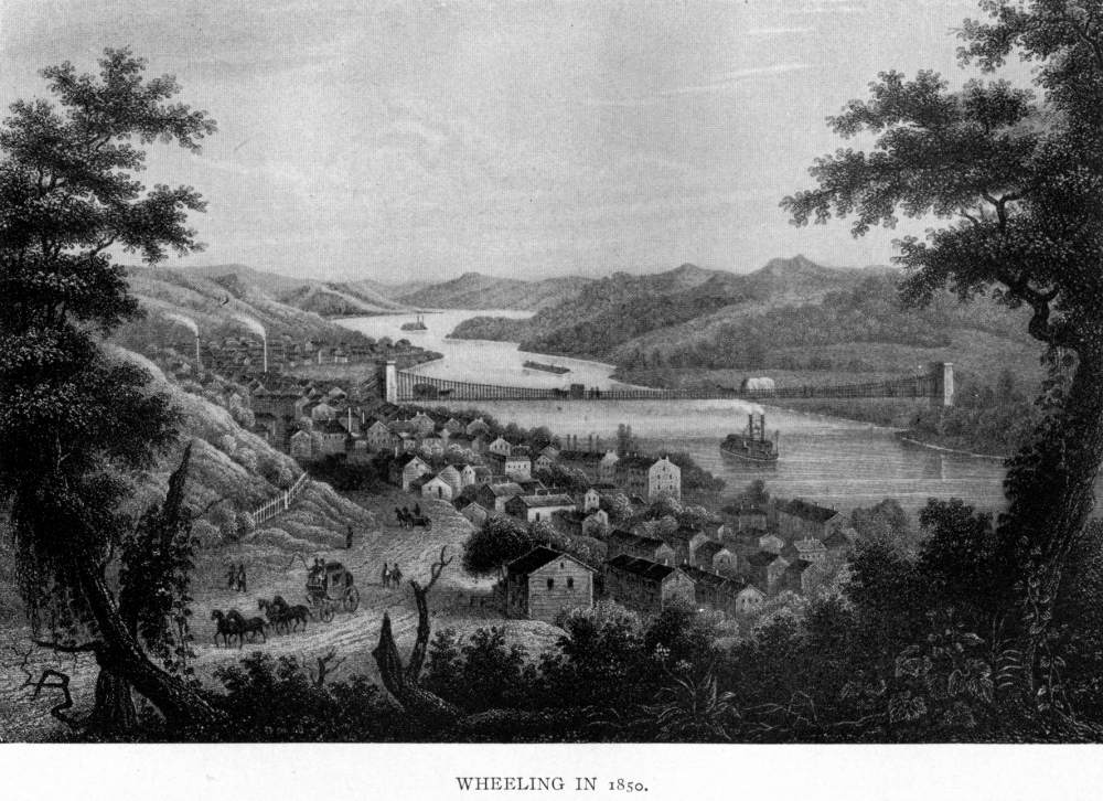
morning in May, 1770, Ebenezer Zane arrived upon the site of the city of
Wheeling, of which he was the founder; Thomas Williams, William McCoy,
William Hughart and John Jordan located the same year at and near the site
of Williamsburg, now in Greenbrier county; Christian Peters came to what
is now Petersburg, in Monroe county, in 1771; Adam Mann, Valentine Cook
and Isaac Estill fixed their habitations near him the same year. Jacob
Wetzel built his cabin on Wheeling creek, Ohio county, in 1771, and a year
later Joseph Tomlinson found a home on the Grave creek flats, where
Moundsville, in Marshall county, now stands; James and Thomas Parsons
located at the Horse-Shoe Bend, on Cheat River, now in Tucker county, in
1772; William McClung and Andrew Donnally came to the vicinity of the
present town of Frankfort, in Greenbrier county, in 1773, and Leonard
Morris reared his cabin on the site of old Brownstown, now Marmet, on the
Great Kanawha River, in 1774. Thus were the homes of civilized men
established over all the region from the Alleghany Mountains to the Ohio
River. Speedily were these joined by other homeseekers in the wilderness,
and so many came that in 1775 there were 30,000 people residing in what is
now West Virginia.
In these years of peace the
English sought to extinguish the Indian's title to West Virginia. This was
accomplished by the terms of the treaty of Fort Stanwix - now Rome - New
York, in 1768, when the Six United Nations ceded to the King of England
practically all of West Virginia, except what was known as the "Indiana
Cession." This was a region within West Virginia which the Six Nations
reserved in their cession to the King, and granted to Capt. William Trent
and other Indian traders in consideration of merchandise taken from them
by the Indians on the Ohio in 1763. Its extent is shown by the statement
that it included of present West Virginia counties within its bounds,
one-half of Wood, two-fifths of Wirt, one-third of Calhoun, one-half of
Gilmer, one-tenth of Braxton, one-sixth of Randolph, and all of Pleasants,
Ritchie, Lewis, Upshur, Barbour, Doddridge, Harrison, Taylor, Monongalia,
Wetzel and Tyler-a total area of 4,950 square miles, or 3,168,640 acres.
The General Assembly of Virginia repudiated the title and the traders
never came into possession of any part of the cession.
The "Province of Vandalia"
has the most interesting history of any embryo state west of the
Alleghanies. As early as 1756 Governor Dinwiddie had urged upon the
English government the necessity of founding a new province in the Ohio
Valley. Later the scheme was supported by a number of statesmen, among
them Lord Halifax. A petition signed by eminent Virginians went over-sea
in 1772, praying for the establishment of a separate government for a
province to the westward, to be known by the name of "Vandalia," the
capital of which was to be located at the mouth of the Great Kanawha
River, now Point Pleasant in Mason county. Within the boundaries as then
defined were included forty of the present counties of West Virginia. The
charter had passed the seals, but the renewal of the Indian wars and the
beginning of the Revolution put an end to the scheme.
Another embryo state west
of the Alleghanies was that known as the "Province of Westsylvania,"
within the bounds of which lay nearly all of the present state of West
Virginia. The scheme was inaugurated by Daniel Rogers and others in July,
1776. It had its origin in the condition of the people who had settled in
the Monongahela Valley, within the region claimed by both Virginia and
Pennsylvania. Two plans were suggested; one was that they should assemble
and send delegates to a convention at Fort Beckett, there to organize a
government, and thus become the "fourteenth link in the American chain." A
second was that they should send petitions to the Continental Congress,
praying that body to declare the said country an independent province to
be hailed and known as "Westsylvania." The War of Independence put an end
to this scheme, as it had to that of establishing the province of
Vandalia.
The "District of West
Augusta" was one of the historic and military divisions of West Virginia.
It is a name never to be forgotten as long as the history of the state is
known. It embraced the whole of northern West Virginia lying westward of
Hampshire county, and included two-thirds of the present county of
Randolph, one-half of Barbour, one-third of Tucker, half of Taylor,
one-third of Preston, nearly the whole of Marion and Monongalia,
one-fourth of Harrison, one-half of Doddridge, two-thirds of Tyler, and
the whole of Wetzel, Marshall, Ohio, Brooke and Hancock. Within it lived
as heroic and patriotic a people as ever dwelt upon the confines of
civilization. They withstood the storm of savage warfare, and were ready
for the service of their country at the first drum-tap of the Revolution.
The "District of West Augusta" was extinguished by an act of the General
Assembly in 1776, when the counties of Ohio, Monongalia and Yohogania were
formed therefrom. The latter was largely cut off to Pennsylvania by the
western extension of Mason and Dixon's Line, and the residue was added to
Ohio county.
More Indian Wars: Battle
of Point Pleasant.
The ten years' truce was
ended; Indian hostilities were renewed, and the year 1774 brought with it
that series of military movements known as Lord Dunmore's War. This
resulted from the treachery of both the whites and the Indians. On April
16 of that year, a large canoe filled with white men was attacked by
Indians near Wheeling, and one of them in it killed. A party of about
thirty frontiersmen hastened to Baker's Station, which was opposite the
mouth of Yellow Creek, and in what is now Grant district, Hancock county,
where, under circumstances of great perfidy, they killed ten Indians,
among whom were some of the relatives of Logan, a distinguished chieftain
of the Mingo tribe. War was now inevitable, and the storm burst with all
its fury on the West Virginia frontier. Bands of warriors laid waste the
settlements, and men and women fell victims to savage barbarity.
Messengers bore the tidings of bloodshed to Williamsburg, the colonial
capital of Virginia. The governor, John Murray, fourth Earl of Dunmore,
ordered Maj. Angus McDonald to collect the settlers on the Upper Potomac
and invade the Indian country. He obeyed the summons, and hastened to
Wheeling, where he erected Fort Fincastle (afterward Fort Henry). In June,
with 400 men - nearly all West Virginia pioneers - he descended the Ohio
to the mouth of Captina creek and marched thence to the interior of what
is now the state of Ohio, where he burned the Indian towns and laid waste
the cornfields. This done, the army returned to Wheeling, whence many of
the men returned to their homes.
The war continued, and Lord
Dunmore, having ordered Gen. Andrew Lewis to collect an army of 1,500 men
in the counties of Augusta, Botetourt and adjacent territory, left the
gubernatorial mansion, and hastening over the Blue Ridge, fixed his
headquarters at "Greenway Court," the home of Lord Fairfax, which stood
thirteen miles southeast of Winchester in the Shenandoah Valley. Here he
engaged in mustering a force consisting of a like number to form the
northern or right wing of the army destined for the invasion of the Indian
country; that under General Lewis was to constitute its southern or left
wing. General Lewis made Camp Union, now Lewisburg, in Greenbrier county,
the place of rendezvous, and having assembled an army of 1,480 men, began
the march of 160 miles through a trackless wilderness to the Ohio River.
This force consisted of the Augusta regiment commanded by his brother,
Col. Charles Lewis, the Botetourt regiment under Col. William Fleming, and
a battalion from the Watauga and Holston settlements, at the head of which
was Maj. William Christian. Both regiments reached the mouth of the Great
Kanawha River on Oct. 6, 1774, where, on the 10th ensuing, they waged the
most desperate battle ever fought with the Indians in the valley of the
Ohio. The Indian army, probably equal in numbers to that of the
Virginians, was composed of the best warriors of the Shawnee, Delaware,
Mingo, Wyandotte and Cayuga tribes, led by their respective chiefs, at
whose head was Cornstalk, sachem of the Shawnees and head of the Western
Confederacy. The battle, beginning at day-dawn, continued until evening,
when the Indians, beaten, retreated across the Ohio. The Virginians had
seventy-five killed and 140 wounded. Meantime Lord Dunmore with the
northern wing of the army had proceeded by way of Fort Pitt, and descended
the Ohio to the mouth of Hockhocking River. From there he proceeded
through the wilderness to the Pickaway Plains in the Valley of the
Scioto-noir. General Lewis having cared for the dead and wounded, crossed
the Ohio with 1,000 men and marched for the same destination. Arriving
there the two divisions were united, and Lord Dunmore made a treaty known
as that of "Camp Charlotte," by the terms of which the Indians were kept
quiet for three years. The Virginians returned to their homes well pleased
with the results of the war.
West Virginia in the
Revolution.
West Virginia did her full
part in the Revolution, and may be regarded as the "fourteenth link in the
American chain" in the struggle for independence and national life. This
is attested by a vast mass of documentary evidence still preserved. The
units of government then existing within what is now the state were the
"District of West Augusta" and the counties of Hampshire, Berkeley,
Monongalia, Ohio and Greenbrier, the latter being formed in 1777. When
intelligence of the battle of Lexington reached the frontiersmen of West
Virginia, hundreds of them hastened away to old Fort Pitt-then believed to
be within the confines of Virginia-where they assembled in convention,
and, having by resolution pledged their lives to the cause of American
liberty, proceeded to elect John Harvie and John Neville to represent them
in the convention at Williamsburg in May ensuing. In this body they were
admitted to seats "as the representatives of the people of that part of
Virginia which lies to the westward of the Alleghany Mountains." The first
company of enlisted men from the south of the Potomac that joined
Washington at Boston was Capt. Hugh Stevenson's Berkeley County Riflemen.
It left Morgan's Spring, now in Jefferson county, July 17, 1775, "not a
man missing," and on arriving at the American camp was introduced by its
captain as being "from the right bank of the Potomac." General Washington
knew some of these men personally, and passing along the line shook the
hand of every man in it.
Capt. William Darke and
Captain Beale each organized companies of Berkeley county men for the
Fourth Regiment on Continental establishment. Capt. James Parsons with a
company of Hampshire county men hastened away to the field and served in
the Third Regiment; Capt. Jacob Westfall's Riflemen, from that part of
Monongalia now Randolph county, was attached to the Eighth Regiment, and
rendered faithful service; Capt. James Booth's Company of Frontiersmen,
from what is now Harrison and Marion counties, served in the western
military department. Greenbrier county with but 550 effective men had, at
one time, 174 of them in service, some in the Continental army and others
with General Clark in his western campaigns.
On Jan. 8, 1777, the
Continental Congress ordered the West Augusta Battalion to join Washington
in New Jersey. This was part of the Thirteenth Virginia, commanded by Col.
William Crawford, then stationed at Pittsburg, and known as the "West
Augusta Regiment" because its rank and file were composed almost entirely
of West Virginia pioneers, whose homes were within the bounds of the old
historic "District of West Augusta," men as brave as any that ever faced
an enemy. Garrett Van Meter, county-lieutenant of Hampshire county, kept
his commissary and quartermaster busy collecting supplies in the valley of
the South Branch of the Potomac, and these were sent to the armies-some by
way of Pittsburg to General Clark for use in his western campaigns. Edward
Snickers went to and fro over the Lower Shenandoah Valley-now Berkeley and
Jefferson counties-collecting corn, wheat' and other supplies for the
Continental army, and Mabre Maden, of Berkeley, used his teams to haul
these to points where needed. John Evans, county-lieutenant of Monongalia,
gathered supplies up and down the Monongahela River, and sent them to the
Thirteenth Regiment and other troops of the western military department at
Pittsburg. In 1776 some of the British prisoners, taken by Captain Barron
on the sloop-of-war Oxford, were sent to Berkeley county for safe keeping,
and their wants were supplied by the people of that vicinity; and in 1781
the Hesse Hanau Regiment (Hessians) prisoners, 300 strong, were sent to
Berkeley Springs in Berkeley (now Morgan) county, where they were guarded
and fed by West Virginians until the close of the war. Verily West
Virginia did her part in the struggle for independence.
Each unit of government
within her limits had its own Committee of Safety, working harmoniously
with the State Committee of Virginia, and it may be said that not one of
them ever failed to respond cheerfully and with a true patriotic spirit to
every requisition made upon each and every one of them, be it for men for
the Continental army, or for the Virginia state line, for horses,
provisions, clothing or other supplies for the armies battling for
national existence. West Virginians were on nearly all the battlefields of
that war, and there are more graves of Revolutionary soldiers in West
Virginia than in any other American state, outside of the thirteen
original commonwealths.
In 1776 Virginia adopted a
constitution which continued to be the organic law of the commonwealth
until 1830-a period of fifty-four years. It provided for a government
having a division of powers -legislative, executive and judicial-but in
reality almost all power, instead of being vested in the people, was
reserved to the legislative branch, called the General Assembly. This body
consisted of two houses-a senate and a house of delegates. The former,
when organized, contained twenty-four members, while the latter was
composed of two members from each county, chosen annually by the votes of
the freeholders. A governor and a Privy Council, or Council of State,
consisting of eight members were elected annually by the General Assembly,
the latter to assist in the administration of the government. Likewise,
the judges of the court of appeals, the general court, judges in chancery,
judges in admiralty, secretary and attorney-general of the commonwealth
were all elected by that body, but commissioned by the governor, who was
vested with the appointing power of all county officials except members of
the General Assembly, who, as stated, were elected by the people, whose
right to vote was determined by a property qualification. We shall see how
the provisions of this constitution produced dissension in the western
portion of the commonwealth-now West Virginia.
Development After
Revolution.
The Revolution terminated
in 1783, but not so the border wars. The Indian nations of the Ohio
wilderness had been the allies of the English since 1777, and for twelve
years after the treaty of Paris they continued to wage a fierce and
relentless warfare upon the frontier civilization. Throughout all these
years they carried death and destruction into the West Virginia
settlements, and spread desolation throughout the valleys and along the
tributary streams of the Great Kanawha and Monongahela rivers, and on the
southern banks of the Ohio. Block-houses and stockade forts-places of
defensive and offensive operations-were erected in many localities, and
the scenes that transpired about them and in the cabin homes nearby in
these years are without a parallel in the annals of barbarian warfare.
These West Virginians were ever ready to yield up their lives in defense
of their homes, and when not engaged in defending them were much of the
time on expeditions into the Indian country. Some were at St. Clair's
defeat, and others at Wayne's victory at Fallen Timbers. This last forever
ended the Indian wars on the south side of the Ohio. Henceforth the
pioneers dwelt in their cabin homes without fear of savage fury. It may be
truthfully said that when these border wars were ended, more men, women
and children had perished at the hands of the savage foe-victims of the
stake, rifle, tomahawk and scalping knife-in West Virginia, than had died
from similar causes in any other region of equal extent in America.
Moorefield, the seat of
justice of Hardy county, in the South Branch Valley. was the designated
place of rendezvous, and from here marched the West Virginians who served
in the National army in its campaign for the suppression of the whiskey
insurrection in western Pennsylvania in 1794.
It had been said of the
West Virginia pioneers that they belonged to a class of men who were
"farmers to-day, statesmen to-morrow and soldiers always." This appears to
have been true. When the Virginia Federal convention convened at Richmond
June 2, 1788, to take into consideration the proposed form of Federal
government - the National constitution-there sat in it sixteen members for
the eight West Virginia counties then checkered on the map of Virginia.
These counties, with their representatives in that convention, were as
follows:
Berkeley County-William
Darke and Adam Stephen.
Greenbrier County-George Clendenin and John Stuart.
Hampshire County-Andrew Woodrow and Ralph Humphreys.
Hardy County-Isaac Van Meter and Abel Seymour.
Harrison County-George Jackson and George Prunty.
Monongalia County-John Evans and William McCleery.
Ohio County-Archibald Woods and Ebenezer Zane.
Randolph County-Benjamin Wilson and John Wilson.
Every one of these men were
farmers at home; every one had seen military service during the Revolution
and Indian wars, and all were acting the part of statesmen now. Who shall
say to what extent ! On the final vote, fifteen of them voted to ratify
the Federal constitution, but one of them-John Evans, of the county of
Monongalia-voting against it. The final vote stood 89 ayes and 79 noes. If
the fifteen West Virginia members had voted no, Virginia would not have
ratified the constitution, and who can tell what effect such a result
would have had upon the formation of the Union?

In the year 1800 there was
a busy population which had grown from 55,875 in 1790, to 78,592 at the
close of the century. Homes of thrift and industry gave evidence of many
years of settlement in the eastern Pan-Handle and along the Upper Potomac,
while from the Alleghanies to the Ohio, cabin homes dotted the landscape.
Thirteen of the present counties-Hampshire, Berkeley, Monongalia, Ohio,
Greenbrier, Harrison, Hardy, Randolph, Pendleton, Kanawha, Brooke. Wood
and Monroe - then had an existence ; and Wheeling, West Liberty,
Wellsburg, Clarksburg, Parkersburg, Martinsburg, Lewisburg, Romney,
Charles Town, Shepherdstown, Point Pleasant and Charlestown, had become
towns of importance for that day. Another decade passed away and brought
the year 1810, at which time the population had grown to 105,469. The
first newspaper published in West Virginia-The Potomac Guardian and
Berkeley Advertiser-had been founded at Martinsburg in 1789, and now a
half dozen more had been established in other towns. Randolph Academy at
Clarksburg, the western representative of William and Mary College, was
founded in 1787; this had been followed by other academic schools at
Shepherdstown, Charles Town, West Union and Lewisburg, while a system of
"Old Field Schools" had grown up in rural districts under the Virginia
School Law of 1796.
Western Virginia in the
War of 1812.
When the second war with
England-that of 1812 -began, West Virginia was ready, as she had been when
the war of the Revolution commenced. On April 10, 1812, President Madison
issued a call for 100,000 men, and five days later the secretary of war
informed Gov. James Barbour that, of this number, Virginia's quota was
12,000. Maj. Samuel McGuire, of Romney, Hampshire county, was the first
West Virginian who tendered his services to the governor. He said:
"Whenever we are compelled by the insolent and perfidious conduct of a
foreign government to relinquish the happy situation in which our country
has so long flourished, and resort to war, it becomes the duty of every
citizen to make a solemn declaration of his determination to support his
government in the prosecution of such a war to the utmost limits of his
means." Capt. James Faulkner's Artillery Company of Martinsburg, Berkeley
county, was the first West Virginia organization ordered into service, and
the second was a company of Light Infantry of the same county; it belonged
to the Sixty-seventh Regiment of Militia, of which Elisha Boyd was
colonel. On May 21 Captain Buckmaster's company of Light Infantry was
ready to march from Jefferson county, and Capt. Carver Willis was
enrolling another at the same place. In this month Capt. Nimrod Sanders,
commanding a cavalry company, and Capt. James Laidley at the head of a
rifle company, both of Parkersburg, Wood county, informed Governor Barbour
that they were ready for service. In July, Capt. Samuel McClure's cavalry
company, eighty strong, of Wheeling, was waiting orders to march. On
August 27 Capt. John Connell wrote General Biggs that he only awaited his
orders to march with the Brooke county Volunteers. On the receipt of the
news of the surrender of Detroit by General Hull, 250 men of the Northern
Pan-Handle assembled at Wellsburg, Brooke county, and declared their
readiness to march to the northwest under the leadership of Captain
Connell. There were no provisions and a deficiency in arms, but James
Marshall, George Getter, Robert Hartford, William Wattenbee and Jacob De
Camp, men of means, offered to furnish all supplies and await payment from
the National government. Home-woven linen was purchased, and Wellsburg
women made it into tents and knapsacks. But it was deemed best to consult
the governor as to this action, and await a later movement.
But West Virginia was to
have a distinct part in the second war with England. On Sept. 1, 1812, Mr.
Eustis, secretary of war, informed Governor Barbour of the order of the
President to him to call out and equip, in addition to the state's quota
of 12,000 troops, 1,500 more destined to cooperate with the northwestern
army, and to have these troops convenient for their march to the western
frontier of Ohio. Governor Barbour hastened to comply with this order. He
determined to raise these troops west of the Alleghanies, that is, in West
Virginia, and accordingly informed the military officers of that region of
this intention. Point Pleasant, at the mouth of the Great Kanawha River,
in Mason county, was fixed as the place of rendezvous, and the troops
ordered to proceed thither. Brig.-Gen. Joel Leftwich, of Bedford county,
Virginia, a veteran of the Revolution, who had been wounded at Guilford,
was ordered over the mountains to take command of the brigade collecting
at Point Pleasant. He reached his destination at 3.00 P. M., Sept. 26,
1812, where he found 825 men, officers included; detachments were arriving
almost daily; none were there from the counties of Hampshire, Hardy,
Monongalia or Randolph, but he understood they were on the march and were
expected in five or six days. On September 15, Capt. John Connell, of
Brooke county, who had been promoted to the rank of colonel, and who had
received orders to join General Leftwich at Point Pleasant, issued orders
to the militia captains to assemble at Wellsburg in that county on the 22d
ensuing. On the same day he wrote Governor Barbour, saying: "The sons of
the northwest corner of the state will do their duty." He said his staff
was complete, and formed of gentlemen fit and capable of performing
service; that he, with his troops, was going to Point Pleasant by water,
that being the cheapest and most expeditious way of getting there; and
that his quartermaster was then employed in placing the baggage on the
boats. He also said that the men in the Light Infantry companies of
Captains Wilcoxon and Congleton and Captain McClaney's Troop of Light
Horse were greatly disappointed because they were left behind. Colonel
Connell, with the troops accompanying him, arrived at Point Pleasant on
the second day of October, 1812. General Leftwich writing Governor Barbour
ten days thereafter, said that there were then 1,311 men, including
officers, and that only a few small detachments were yet to arrive; that
the army was being organized and drilled, and that it was a fine body of
men, all in high spirits. He had received a letter from the secretary of
war ordering him to march as soon as possible to the frontier
(northwestern) of Ohio, there to report to the commanding officer of the
Northwestern army. On the same day orders came from General Harrison dated
"Piqua, Sept. 27, 1812," informing him that his destination was Wooster,
in Wayne county (Ohio), forty-five miles west of Canton, and his line of
march was by way of New Lisbon and Canton, and that at Wooster the
Virginians (West Virginians) would be joined by a brigade from western
Pennsylvania, when all would proceed to the Rapids of the Maumee, there to
form the right wing of the Army of the Northwest. General Leftwich broke
camp at Point Pleasant, and with his troops ascended the Ohio, beyond
Wellsburg, and then proceeded through Columbiana and Stark counties to
Wooster, and thence to the northwest. John Mallory, commissary-general of
General Leftwich's brigade, writing Governor Barbour from Delaware, Ohio,
under date of Jan. 24, 1813, informed him that in the past four days he
had loaded at that place 700 pack-horses, 60 wagons and 100 sleds with
flour and other quartermaster stores; that he was then paying two dollars
a bushel for corn, and that the troops had a sufficient supply of
provisions and ammunition. He adds: "I am getting tolerably fond of a
soldier life if it were not for leaving my family." Henceforth the history
of General Leftwich and his West Virginia brigade, with that from western
Pennsylvania, is part of that of the Army of the Northwest, of which the
two formed the right wing.
Fight for Democratic
Government.
The year 1816 is a most
important date in the history of West Virginia. The constitution adopted
in 1776 had been in force for forty years, and it had been shown to
contain many defects. The unequal representation of the counties gave to
it a sectional character-all having the same representation-two members-on
the floors of the General Assembly, and this, too, regardless of wealth or
population. The constitution had been framed by Burgesses representing a
population residing exclusively in the Tide-Water Region, and consequently
at that time homogeneous in character and identical in interest. Now this
was changed, and with the increase of population and the organization of
counties west of the Blue Ridge, the principle was reversed, and what had
been equal representation had become unequal representation ; and while
some of the western counties paid into the public treasury many times the
amount paid by some of the eastern counties, the representation of each
was the same. As an example of this, Hampshire county in the west, with a
population several times as great as Warwick in the east, paid twelve
times as much revenue to the state, while both had the same representation
in the General Assembly.
Then, too, the limitation
of the right of suffrage to freeholders and the elective power vested in
the General Assembly, gave to the constitution an aristocratic character.
These requirements secured to the east the balance of power and rendered
the west almost powerless in all matters of state legislation. In an
assembly having 204 members, the former had 124 while the latter had but
80. The result was that the east secured to itself nearly everything in
the character of internal improvements. For forty years the state revenues
had been collected in West Virginia counties, and yet it appeared that in
1816 but $6,500 had been paid out of the public treasury for improvements
west of the Alleghanies, while $123,661.11 had been expended for this
purpose east of the Blue Ridge; and that in addition thereto, in the same
time, $794,700 of the public monies had been invested in the stocks of the
Bank of Virginia and the Farmers' Bank of Virginia, both at Richmond.
The same year the General
Assembly created a board of public works consisting of thirteen members,
of which number eight were to reside east of the Blue Ridge. A belief
obtained that the past policy in regard to public improvements would be
continued; there was great dissatisfaction among the men who were felling
the forests from the Alleghanies to the Ohio, and mutterings of discontent
were heard on every hand. It was evident that a redress of the grievances
complained of could never be secured under the existing constitution, and
from 1816 the question of a convention to revise that document was
agitated. Much opposition was developed, and it was only after repeated
failures covering a period of twelve years that the General Assembly
passed an act in 1828, providing for taking the sense of the voters upon
the call of such a convention. Later in the year the proposition was
carried by a vote of 21,896 to 16,646. Of the majority, by far the greater
number of votes composing it were cast in the western counties of the
state, where the greatest opposition to the existing constitution had been
manifested.
The convention assembled at
Richmond, Oct. 5, 1829, and it was the most remarkable body of men that
had assembled in Virginia since that which ratified the Federal
constitution in 1788. It consisted of ninety-six members, of whom eighteen
were from the territory now embraced in West Virginia. They were among the
wisest and most discreet men of the region they represented. In the
organization of the convention, no western man was mentioned in connection
with an official position. From the beginning of the session the
conflicting interests of the two sections became more and more apparent,
and the representatives from each were arranged in almost solid phalanx on
opposite sides of nearly every question. At length the work was done, but
none of the reforms sought bad been secured. The right of suffrage was
still restricted to a property qualification, and the west denied equal
representation. Thus all of the objectionable features of the old
constitution were engrafted into the new. Upon the final vote upon its
adoption by the convention, every delegate from the west side of the
Alleghanies voted against it, with the single exception of Philip
Doddridge, who was unable to attend, being ill at his hotel. But it was in
the popular vote that the opposition of the two sections-the east and the
west-was most evident. The total vote cast was 41,618, of which 26,055
were for ratification and 15,563 for rejection. Every county east of the
Blue Ridge with one exception, Warwick, gave a majority for ratification,
while every county then existing in what is now West Virginia, with two
exceptions, Jefferson and Hampshire, voted largely for rejection. In them
were cast 9,758 votes, of which 8,375 were for rejection.
Western Virginia From
1830 to 1860.
In 1830 twenty-three of the
present West Virginia counties had an existence, and towns and villages
dotted the landscape here and there over all the state. By the census of
1830 the population was 176,924, grown to this number from 136,768 ten
years before. Its character was that of a vigorous people. In the towns
were the country merchants dealing in every line of merchandise; they were
men of character and business integrity. When a wholesale dealer in
Baltimore was asked where he found his most reliable and trusted retail
merchants, he promptly replied: "In Western Virginia." Here were the homes
of lawyers, physicians and ministers, and in each class were men of
brilliant intellects. In the river valleys and on the rich uplands dwelt
by far the larger part of the population; farmers who, in addition to
producing wheat, corn, buckwheat, potatoes and fruits for their own use,
generally had a surplus to sell to others; they also raised good horses,
cattle, sheep and hogs. Still another class dwelt in the "hill country,"
where they built their cabin homes and cleared a few acres of land on
which they produced grains and vegetables sufficient for their own needs
from year to year; they had but few domestic animals, and for other food
they depended largely upon wild game and fish. Periodically they visited
the towns, there to barter venison, skins, furs, maple-sugar and ginseng,
for clothing, coffee, medicines, ammunition and other necessities, and
then returned to their homes to follow the same routine to the end of
their lives. All classes were far removed from the marts of trade, and
almost entirely isolated from society, yet they carved out a society of
their own and established a code of morals as rigid as any known in older
lands.
All were united in an
effort to secure equal representation, a fair system of equal taxation, a
just share of the public monies expended for internal improvements, and a
suffrage law untrammeled by property qualifications. Not one of these had
been guaranteed to them by the provisions of the new constitution, and so
much were they opposed to it that state division at once became a theme of
earnest discussion. As the years passed away the people assembled to give
utterance to their grievances. That of unequal representation in the
General Assembly was among the most serious. This was set forth in the
action of a great convention assembled at Charleston, in the Great Kanawha
Valley, Aug. 9, 1841. The object was stated to be "for the purpose of
considering the inequalities of the representation in the General
Assembly, and the deep interest of the western people in a reappointment
of the senators and delegates comprising the General Assembly." Many of
the strongest men of West Virginia were present. Judge Lewis Summers was
made chairman and Alexander W. Quarrier secretary. The four physical
regions, as the commonwealth then existed, were regarded as political
divisions. These were known as (1) the TideWater Region; (2) the Piedmont
Region; (3) the Valley Region, and (4) the Trans-Alleghany Region, the
latter including nearly all of West Virginia. A "memorial" addressed to
the General Assembly set forth some remarkable facts. It was shown that an
equal apportionment of the 134 members of the House of Delegates would
give to each a constituency of 5,532 of white population, and 644 of
qualified voters. Instead of this, the following inequalities were shown
to exist : the thirty-one delegates from the Trans-Alleghany Region each
represented a white population of 7,584 persons and 836 qualified voters;
twenty-five delegates from the Valley Region each represented a white
population of 5,472 persons and 644 qualified voters ; forty-two delegates
from the Piedmont Region each represented a white population of 4,738
persons and 572 qualified voters; thirty-six delegates from the Tide-Water
Region each represented a white population of 4,737 persons and 558
qualified voters. In the senate as then existing there were thirteen
members from western Virginia and nineteen from eastern Virginia. Each
western senator represented an average population of 28,903 persons and
3,256 qualified voters, while each eastern senator represented a white
population of 19,448 persons and 2,342 qualified voters.
Such was the unequal basis of representation in Virginia at this time.
Thus it was that the east was enabled to secure large appropriations for
internal improvements, while the west, as asserted by its people, was
unable to obtain its just proportion of the public monies for this
purpose. Many instances of this were cited by them.
Once more it became evident
to these people that a redress of their grievances could never be obtained
under the existing constitution, and they demanded a revision of that
document. This was provided for by an act of the General Assembly passed
March 9, 1850, and a constitutional convention assembled at Richmond on
October 14 ensuing. After months of labor it finished its work, and under
the provisions of this constitution came a redress of many of the
grievances complained of by the people of the west. The right of suffrage
was extended, taxation rendered more equitable, and the basis of
representation so remodeled as to secure to this section greater equality
in the halls of legislation, and it now seemed that harmony would
henceforth exist between the east and the west. But this was not to be.
Geographically, the east
was separated from the west by mountain ranges which, so far as trade and
commerce was concerned, proved an almost impassable barrier. This was so
great that no artificial means of intercourse between the two sections had
been made beyond a turnpike road. All trade and commercial relations of
the west were with the other states and not with eastern Virginia.
Merchants in western Virginia made their purchases in Baltimore, Pittsburg
and Cincinnati, and they knew no more of the wholesale trade of Richmond
than they did of Boston. The two sections were entirely dissimilar in
their social relations. While the east was largely interested in slaves,
the west had comparatively few of them, and nearly all labor was performed
by freemen. The mode of taxation, as well as that of representation in the
legislature, had long been the source of irritation and indeed of strife
and vexation between the two sections. For many years the subject of
internal improvements created dissension, 'the people of the west
asserting that they paid state revenues largely in excess of what they
received in the expenditure of public funds in their section. Because of
these things, men residing there who had grown old and gray had heard the
subject of state division discussed since they were children. Years came
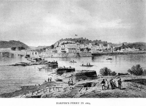
and went, and brought John Brown's insurrection at Harper's Ferry. The
intelligence that went out from that place on the morning of Oct. 17,
1859, sent a thrill of terror throughout Virginia, and astonished the
whole nation. The year 1860 found Virginia in a state of the greatest
commotion-a condition unexampled in history unless it be that of France in
the early days of the Revolution. Governor Letcher, influenced by the
pressure of the times, issued a proclamation convening the General
Assembly in extra session. That body provided for a convention of the
people of Virginia. There were 152 members, of which 47 were from the
west. Every student of history knows what the action of that body was, and
the world knows the result. The war came; it furnished the opportunity for
the division of the commonwealth, and when the storm had passed away there
were two states where one had been before. And now, Virginia-the
Mother-and West Virginia -the Daughter-reside upon the ancient estate.
BIBLIOGRAPHY. - Aler, F. Vernon: History of Martinsburg and Berkeley
County (Hagerstown, Md., 1888); Atkinson, George W.: History o f Kanawha
County (Charleston, 1876); Bickley, George W. L.: History of the
Settlement and Indian Wars of Tazewell County (Cincinnati, 1852);
Breckenridge, H. M.: Recollections of Persons and Places in the West in
1792 (Philadelphia, 1868); Bruce, Thomas: Heritage of Trans-Allegheny
Pioneers (Baltimore, 1894); Cranmer, Gibson Lamb: History of the Upper
Ohio Valley (Madison, Wis., 1890), History of Wheeling City and Ohio
County (Chicago, 1902); Cutright, W. B.: History of Upshur County (1907);
Doddridge, Joseph: Notes on the Early Settlement and Indian Wars of the
Western Parts of Virginia from 1763 to 1783, Inclusive (Wheeling, 1824);
DeHass, Wills: History of the Early Settlements and Indian Wars in
Northwestern Virginia (Wheeling, 1851); Dunnington, George A.: History and
Progress of the County of Marion (Fairmont, W. Va., 1880); Ely, William:
History of the Big Sandy Valley (Cattlattsburg, Ky., 1887); Fernow,
Berthold; The Ohio Valley in Colonial Days (Albany, N. Y., 1890);
Garrison, Wendell Phillips: The Prelude to Harper's Ferry (Andover, Mass.,
1891); Gibbons, Alvaro F.: A Century of Progress; or, A Historical
Souvenir of Wood County (Morgantown, 1899); Hale, John P. Trans-Alleghany
Pioneers (Cincinnati, 1887); Jacob, John G.: Brooke County: Being a Record
of Prominent Events in that County (Wellsburg, W. Va., 1882); Kercheval,
Samuel: History of the Shenandoah Valley (Winchester, Va., 1833); Lewis,
Virgil A.: History o f West Virginia (Philadelphia, 1889); Lewis, Hale and
Hogg (joint authors): History of the Great Kanawha Valley (Madison, Wis.,
1891); Loudermilk, Will J.: History of Cumberland and Braddock's
Expedition (Washington, 1878); Marshall, O. S.: History of De Celeron's
Expedition to the Ohio in 1749 (Albany, 1887); Mayer, Brantz: Ta-gah-ju-te:
or Logan the Indian and Captain Michael Cresap (1867); Maxwell, Hu.:
History of Tucker County (Kingwood, 1884), History of Hampshire County
(Morgantown, 1897), History of Randolph County (Morgantown, 1899); Moore,
James: The Captives of Abb's Valley (Philadelphia, 1840); Norris, J. E.:
History of the Lower Shenandoah Valley (Chicago, 1890); Newton, J. H.:
History of the Pan-Handle (Wheeling, 1879); Pritts, J.: Mirror of the
Olden Time Border Life (Chambersburg, Pa.); Panghorn, J. G.: History of
the Baltimore and Ohio Railroad (Chicago, 1883); Peterkin, George W.:
Records of the Protestant Episcopal Church in West Virginia (Charleston,
1902); Price, William T.: History of Pocahontas County (Marlinton, 1899);
Ridpath, James: Echoes from Harper's Ferry (Boston, 1860): Sparks, Jared:
The Writings of Washington, Vol. II. (Boston, 1846); Seabright, Thomas B.:
The Old Pike, A History o f the National Road (Uniontown, Pa., 1894);
Stuart, John: Memoirs of the Indian Wars and Other Occurrences (Richmond,
1832); Safford, William H.: The Blennerhassett Papers (Cincinnati, 1861);
Thwaites, Reuben Gold, and Kellogg, Louise Phelps: Documentary History of
Dunmore's War (Madison, 1905), (eds.) The Revolution on the Upper Ohio,
1775-1777 (Madison, 1908); Withers, Alexander Scott: Chronicles of Border
Warfare: or A History of the Settlement by the Whites of
Northwestern-.Virginia and the Indian Wars and Massacres in that Section
of the State (Clarksburg, 1831); Wiley, Samuel T.: History of Preston
County (Kingwood, W. Va., 1880), History of Monongalia County (Kingwood,
1883); Waddell, Joseph A.: Annals of Augusta County (Richmond, 1888);
Calendar of Virginia State Papers (11 vols., Richmond, 1875 et seq.); The
Washington-Crawford Letters Concerning Western Lands (Cincinnati, 1877);
Miller, James H.: History of Summers County (1908).
VIRGIL A. LEWIS,
Historian and Archivist of the State of West Virginia.
History of West Virginia Old and New
In one volume by James Morton Callahan, Professor of History and
Political Science at West Virginia University and West Virginia
Biography in two volumes by Special Editorial Staff of the Publishers.
(1923)
Volume 1
|
Volume 2 |
Volume 3
Myers' History of West Virginia
By Sylvester Myers in two volumes (1915)
Volume 1 |
Volume 2
A History of West Virginia
Wesleyan College 1890-1965
By Kenneth M. Plummer (1965) (pdf) |