The story that the physical site tells is one open to discussion and interpretation. Reason and common sense do not always prevail, and can only act as a guide or suggestion until evidence is adduced to prove or disprove the theory.
We begin with the
tactical sitting of the castle. When
one examines the East Neuk coastline, easily one of the most defensible points
is the promontory that hosts the castle of Saint Monance.
It may be that the earliest inhabitants of the area did not take
advantage of this obvious defensibility, but that would be out of character.
The castle is on a
promontory that has one side which is a straight drop of approximately 50 feet
to the Firth of Forth; another that is slightly more climbable, but very
hostile. A third descends to the
sea in a manner that can be climbed. A
narrow, easily defended neck connects to the coastline.
The sea would have
been the “highway” for residents of the castle site just as it was for the
fishermen who have sailed from St Monans for centuries.
Hopefully, someday
we will be in a position to interpret the traces of those who settled here from
evidence unearthed.
The castle is
located in the East Neuk, that isolated area that juts out into the Firth of
Forth, east of an imaginary line drawn between Edinburgh and St Andrew.
The castle lies between the villages of Elie and St Monans, just 1/3 mile
from the village of St Monans along the footpath and a couple of miles from Elie.
The steeple of the famous church of St Monans is easily seen from the
castle.
To see a map of
the area, go to www.geo.ed.ac.uk/scotgaz/councils/region15.html
To check on the
weather, go to
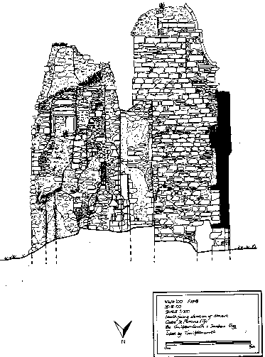
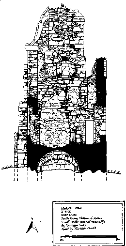
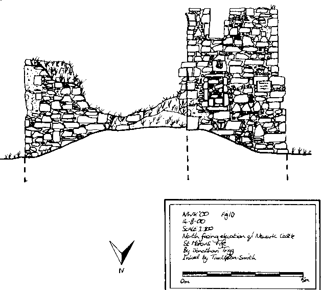
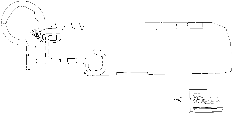
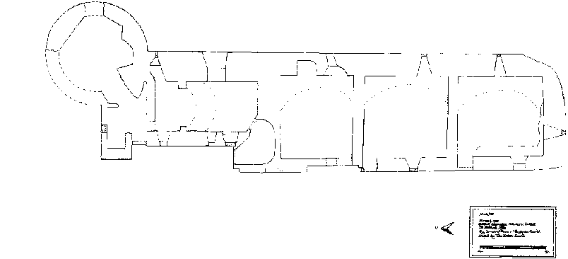
The following are reduced images of a recent survey of the castle structure as it stands on the site:
.gif)
.gif)
.gif)
.gif)