|
Measuring direct from
Blacklunnans to Scurdie Ness near Montrose, and from Cock Cairn to
Buddon Ness, which mark the four extreme points of the modern
county, we get two lines each 36 miles long. Its area is 559,171
acres or roughly 807 square miles, and it is thus the eleventh in
point of size amongst the counties of Scotland. It is less than
one-fifth of Inverness-shire, the largest, and more than twenty-two
times the size of Clackmannan, the smallest. Its boundary line
measures, when zigzags are taken into account, something like 190
miles, of which about 44 are washed by the waters of the ocean and
the firth.
Forfarshire is one of
the most compact of Scottish counties, being nearly circular in
shape. The landward boundary marches with the counties of Perth,
Aberdeen, and Kincardine. To the east of the Ericht and the Shee,
Perthshire “cuts itself a monstrous cantle out”; Aberdeenshire
drives a wedge deeply into its neighbour to the south-east of Loch
Muirk ; and in the north-east by its adherence to the inward curve
of the North Esk, Forfar loses a crescent-shaped mass of land to
Kincardine. With these exceptions the boundary line of the county is
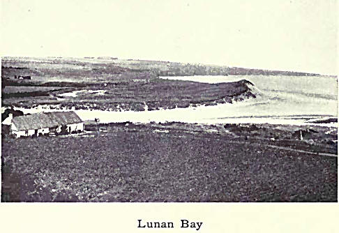
fairly symmetrical. The curve of the coast from Dundee to St Cyrus
is materially broken only by the promontory of Buddon Ness, the
indentation of Lunan Bay, and the tidal waters of Montrose Basin.
The north-west
corner-stone of Forfarshire, sometimes given as the huge, rugged
mass of Cairn-na-Glasha (3484 ft.), is in reality Glas Maol (3502
ft.), the highest summit of which is in the county. The boundary
skirts the edge of the precipices of Creag Leacach as far as Cairn
Aigha, then striking direct south it reaches in the parish of
Blacklunnans its most westerly point, on the Water of Shee. After
following this for a few miles it trends south-east and runs round
the Perthshire Hill of Alyth, and in a zigzag course crosses the
Isla, beyond which it follows for some distance the Dean. A long
tongue of the county then shoots westwards into Perthshire so as to
include the parish of Kettins. From this point to the Tay at
Invergowrie, the line, which once again projects into Perthshire
around the parish of Benvie, is straggling and artificial.
The main range of the
Grampians with its lofty but rounded summits divides Forfar on the
north from Aberdeen. The principal heights are Tolmount, Cairn
Bannoch, Broad Cairn, Dog Hillock, Black Head of Mark, Fasheilach,
Mount Keen, Cock Cairn, Hill of Cat, and Mudlee Bracks. On Mount
Battock the two counties are met by a third—Kincardine. Thence,
passing Sturdy Hill, the county march descends to the North Esk at
The Burn, and follows the course of that river to the sea.
Southward to Buddon
Ness, the county is bounded by the North Sea ; and then westward to
Invergowrie, by the estuary of the Tay. |

