|
The Land of the
Aborigines.
MISSISSIPPI has not had a
continuous history in the same way as England, France or Spain, but the
boundaries, especially on the south and west, are natural, and the peoples
who have flourished there have all left their impress. There are Indian,
French, British and Spanish elements in her make-up, and in a sense the
American is the heir, if not a combination, of his predecessors, working
out the old problem of civilization under new conditions.
Geography.
The physical basis of
history consists principally of the soil, water courses and climate.
Looking at a map of North America we find that while the Mississippi River
receives tributaries on the west from its source to its mouth, there is on
the east no large affluent south of the Ohio River. Thus there is a large
coast region north of the Mexican Gulf whose drainage is directly
southward from the Appalachian range, whose foothills make up a watershed
which not only throws the Tennessee and Cumberland rivers northward to the
Ohio, but is the source of many streams which seek the Gulf of Mexico.
The drainage, then, is from
north to south, more or less parallel with the Mississippi. The watershed
is one thousand feet high in the Pontotoc ridge, and gradually becoming
lower as it runs south in several divisions. These give rise to
considerable rivers, such as the Pearl and Pascagoula, and further east
are the Alabama-Tombigbee, Chattahoochee and other systems. The basins are
of unequal size, and some, as those emptying in Mobile Bay, could give
rise to separate interests; but together they make up one district, the
Old South West, extending from the Mississippi to the Chattahoochee, from
the Appalachian highlands to the Gulf. No fairer land can be found for a
commonwealth.
The country is made up
geographically of several belts, running roughly from east to west, and
cut transversely by these rivers. A large limestone district, known now as
the Black Belt, sweeps in a crescent around the foothills of the
Appalachians, extending southeastwardly from the junction of the Ohio and
Mississippi across these different drainage basins to terminate near the
Atlantic.
Northeastward of this is a
rough country, rich in minerals, but in early times unattractive to man.
Southward of the Black Belt prairies is the Coastal Plain, formed
principally of sand, often underlaid with clay. The fertile lands produced
cereals and nut-bearing trees in great abundance, while the coast was
given over to the pine woods. The transverse river basins, such as the
Mobile, and, par excellence, the Mississippi, were made up of alluvial
soil, and their vegetation was luxuriant. Large game like the deer, bear
and even buffalo abounded, especially in the interior and about the water
courses; birds were numerous and beavers were plentiful, while edible fish
could be caught in every stream.
The Mississippi River, like
the Nile, flowed through a fertile country which it had created. On the
western side and on both sides near its mouth the country was low and
subject to inundations, while on the eastern bank were often found bluffs
like those at Baton Rouge, the Tunicas, Natchez and Vicksburg, which
became a series of hills eastward of the Yazoo River, extending roughly
parallel with the great stream so as to enclose the Yazoo delta and give
it a character of its own. It was intersected with bayous and ranked among
the most fertile districts of America.
In the southwest the
valleys of several streams, like Bayou Pierre, Cole's Creek, the
Homochitto and Thompson's Creek made up a district having special
characteristics. The land was high and yet well watered by these creeks,
which, unlike elsewhere in this country, drained directly to the
Mississippi. What was to become the northwestern and southwestern parts of
Mississippi were, therefore, closely connected with the Mississippi River,
and separated in character of soil and drainage from the prairies further
to the east and the pine barrens of the coast. It may turn out that these
characteristics will leave their mark in the history of the inhabitants.
The climate of this whole
country is temperate. Snow is often known in its northern parts, and ice
occurs down to the coast, but the predominant season is summer. Spring and
autumn are mere names. Cold weather often does not come until January,
while warm weather is sometimes known as early as March. Summer represents
three-fourths of the year, which generally admits of two or three crops of
vegetables. Beans and melons are native to the soil, but the staple
product here, as elsewhere in America, is maize or Indian corn. This grows
so early and so abundantly as to have been in all ages the chief reliance
of the population. Wheat on the one hand and cotton on the other are not
native to this section, and were not known to the native races.
Indians.
The origin of the
aborigines is still an unsolved problem. Their linguistic affinities
divide them into a half dozen great stocks, and the country in which we
are now interested shows traces of several and of their succession. There
are enclaves, like the Biloxi on the Gulf and the much greater Natchez,
Tunicas and Yazoos, whose names show their seats on or near the
Mississippi River, but having affinities with races west of the great
river. They were apparently cut off and surrounded by the great Muscogeean
race, which, in historic times, extended from the Mississippi to the
Atlantic and from the mountains to the Gulf. It would seem as if the
branch which assumed the special name of Muscogee (the later Creeks) broke
off earlier and extended eastward until they reached also the sources of
streams draining to the ocean. The western branch was, at the time when
history begins, subdivided into the Choctaws, Chickasaws and Chocchumas,
who lived eastward of the Mississippi, and indeed the first two were more
in touch with the Tombigbee and other Gulf streams than with the Father of
Waters. The Chocchumas were about Yazoo River and eastward, while to their
north lived the Chickasaws and to the southeast the Choctaws. The Choctaws
claimed the great mound Naniwaya on Pearl River as their "mother," the
place where the Chickasaws left them on arrival from west of the
Mississippi.
The Indians were in the
transition from the hunting to the agricultural age and had not developed
the intermediate pastoral stage, and doubtless this was due to the fact
that there were no native animals which were suited to this condition.
Dogs they had, but no cattle. The buffalo was being extinguished in
historic times, and even the buffalo was hardly a good subject for
domestication. They were not savages, for they used fire, had family,
religion and government. They were in the middle status of barbarism,
making pottery of beauty, and semi-agricultural. Traditions they had,
traditions tied up with strings of beads wrought into belts, handed down
from one generation to another; but this was an esoteric art, known to few
and never taught to strangers. Mexico showed to what height native culture
might attain, but Mexico also showed that it was accompanied by a decline
in bravery or, at least, in the art of war. This stage, whether it be
higher or lower, was not that of the Gulf Indians. They were typically men
of the Stone Age.
Would the Indians advance
to civilization, or would the absence of cattle keep them in barbarism?
Would the advent of other races stimulate them or check their advance?
Could minds which had evolved their inventions and institutions suddenly
adopt those of Europe? Such are the problems before us.
The First Explorers.
Spain, with Columbus'
discovery of the New World, became the leading nation of Europe, and the
wealth of the West Indies, Mexico and Peru attracted many to her new
possessions. As the South was reduced, interest grew in the North, and the
vast province of Florida lured the Spaniards from other fields.
It extended from our
Chesapeake Bay to Mexico, but little was known of it. A governor of
Jamaica ventured in 1519 to send one Pineda to explore, and he reported a
great harbor, which he named Espiritu Santo, about the centre of the north
Gulf coast. In 1528 Narvaez was forced to take ship at Apalache after a
disastrous exploration of peninsular Florida, and soon with most of his
followers miserably perished in storms off the northern coast. But the
indomitable Spaniards were not to be dismayed.
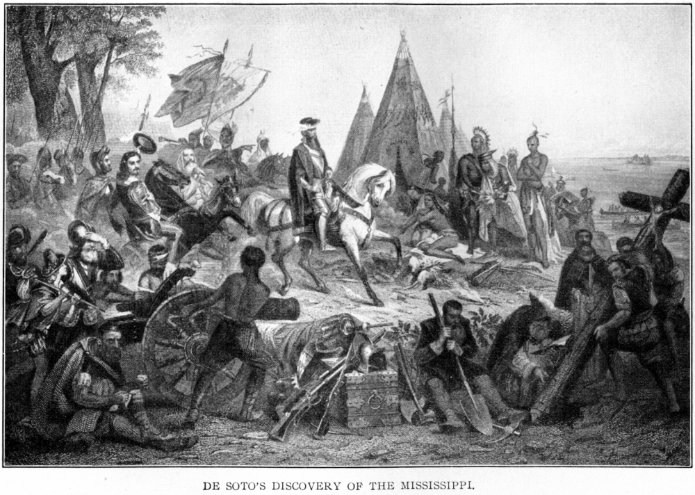
The first European who
penetrated the interior of the Gulf country was Hernando De Soto, who had
acquired wealth and fame in Peru, a typical conquistador. The early route
of De Soto was confined to the Gulf side of the peninsula, and he then
struck northeastwardly and reached streams emptying into the Atlantic.
Afterwards he reached the
sources of a river flowing to the southwest, and according to Biedma this
was known as the Espiritu Santo, which emptied into the Bay of Chuse. In
this Cosa country there were a number of towns, some on islands in the
river, others inland on the watershed between our Coosa and the
Tallapoosa. The Spaniards rested there for several months, but found
little gold. It was a different region, a different race of Indians from
those they had heretofore met. Oaks, walnuts, maize abounded, the towns
were palisaded and the tribes stood in closer relations to each other.
In the fall of 1540 De Soto
proceeded southwestwardly, and, after crossing a large river (the
Alabama), he came to Mauvila, a palisaded town, containing large houses.
Here occurred possibly the most sanguinary battle in Indian warfare. De
Soto was victorious on account of his firearms and armor, but lost many
men and horses, including much of the swine brought with him from Spain.
It was found necessary to remain in the vicinity some time in order to
recuperate.
The men were in favor of
descending to the Bay of Chuse, not over forty leagues away, to meet the
fleet of Maldonado, which De Soto had directed to repair hither, but the
Adelantado had nothing to take back to Cuba and therefore resolved on
proceeding further.. So northwestwardly they took their course, and,
reaching a large river at Zabusta, built a barge and crossed. This was the
Black Warrior, at possibly the place now called Erie.
In December they reached
the River of Chicaca, our Tombigbee, and horsemen forded the stream
probably near the modern Cotton Gin above Aberdeen, where the river
tributaries form an island. After passage came negotiations with the
Chickasaws, during which their chief induced the Spaniards to help him
against the hostile Sacchumas, known to us as the Chocchumas.
De Soto spent the winter in
the Chickasaw country between what is now known as Tupelo and Pontotoc.
The Spanish camp can even now be traced in oblong earthworks.
There being no draft
animals in the country, De Soto, like other Spaniards in South America,
was used to having Indians as burden bearers, and made a practice not only
of taking a chief from one district until succeeded by one from another
territory, but also of impressing several hundred Indian tamemes or
porters. This had been the main cause of much of the hostility which he
encountered, and led the Chickasaws to display their indomitable
independence. They not only refused his demand for porters, but, attacking
his camp, nearly destroyed his whole force. Had they had anything of the
discipline of the Europeans and continued the battle, instead of making a
fierce onset and retiring, there would have been no Spaniards left to tell
the story.

De Soto, perforce, remained
a month, retempering arms, constructing lances of ash and making other
repairs, suffering at the same time repeated attacks from the Chickasaws.
Finally in April, 1541, the Spaniards marched northwest through the
uplands, and after various mishaps reached the Rio Grande, our
Mississippi.
They built barges and
finally crossed over to meet new adventures. After wandering around for
two years, they returned to the Mississippi, determined at last to find
their way back by sea. While they were building boats De Soto died,
probably near Helena, Arkansas, and left Moscoso as his successor. The
survivors reached the sea and coasted along until they found Mexico.
Thus ended for the present
the Spanish exploration of the interior. It was almost barren of results,
no treasures being found and the accounts being so confused as to add
little even to geographical knowledge. Indian paths were followed and no
roads were cut.
In 1558 an expedition was
sent by Velasco, governor of New Spain, to seek out a place suitable for
colonization. His captain Bazares explored from the west as Pineda had
from the east, and thus visited most, if not all, of the harbors. His
description of Bas Fonde and Filipina bays resembles Biloxi and Mobile
waters, and at all events between Pineda and Bazares the coast seems to
have been explored and the way opened for permanent settlement.
Accordingly, next year came the occupation by Tristan de Luna of the
mainland of Florida, at Ychuse, a point apparently between Mobile and
Pensacola bays. He sent an expedition northwardly to Nanipacna, which they
found desolated by white men, doubtless those under De Soto, and they,
too, reached the pleasant land of Cosa. The expedition, however, was
broken up by dissension, and in 1561 the colonists were taken away before
anything lasting had been accomplished.
Attention was henceforth
concentrated upon the Atlantic coast, where St. Augustine was now
established. More interest was felt in securing peninsular Florida, for it
guarded the Bahama passage and thus the route of the plate fleets from
Mexico to Spain.
Santa Elena, in what is now
South Carolina, was one of the points occupied, and the activity of the
Spaniards is shown by two expeditions under Juan Pardo in 1566, the second
of which went as far west as Cosa and even Trascaluza, within a few days,
it was reported, of New Spain. This, however, must have been guesswork, as
there is no record that the Mississippi was reached, and even that river
was a long way from Mexico. Between this and the Atlantic, however, Pardo
established several posts.
There is little evidence
that in the Sixteenth century there was anything more than an occasional
expedition to the interior between the Mississippi and the Chickasaw or
Tombigbee River. On the north coast of the Gulf the harbors were explored
and used, late in the Seventeenth century provinces were claimed with
headquarters at Panzacola and Apalache bays, and in 1670 there was found
need for a boundary treaty with England.
The occupation, however,
was practically limited to the Atlantic, and the Mississippi Valley was at
most within the Spanish sphere of influence.
The French on the
Mississippi.
The descent of Spain was as
rapid as her ascent. Religious and economic reasons can be given, and both
kinds, no doubt, had their influence. England and Holland succeeded to her
power on the ocean, and France superseded her upon land. The French
monarchy, planned by Richelieu, developed by Colbert, was at the end of
the Seventeenth century directed by Louis XIV. Europe was too small for
his activity. All countries already had colonies, and America and India
were explored and exploited for the benefit of the Grand Monarque.
Marquette and Joliet
rediscovered the Mississippi River from Canada in 1673, and descended the
Arkansas, and nine years later the intrepid La Salle explored it to its
mouth, where he took possession of the whole basin and named it Louisiana.
The explorer missed the river when he came to colonize the country from
the sea, and died by the hands of an assassin in what has become Texas.
After the struggle with
William of Orange, Louis took up the question of the settlement of the
vast province named for him. Iberville was sent out, and in 1698 succeeded
where his fellow Canadian had failed and entered the mouth of the
Mississippi. The current was found too strong for the vessels of that day,
and the marshes which constituted its bank offered no inducement to
settlement; but the coast and islands of the sound were visited and named,
and a temporary location sought on the Back Bay of Biloxi, with Ship
Island as its outer bulwark. Iberville and his brother, Bienville,
explored the country, and not only became acquainted with the Indians, but
gradually secured a hold on them from the Gulf to the mountains. Choctaws,
Mobilians, Chickasaws and Alibamons visited the French, and the earlier
advances of the English were overbalanced.
It was determined to effect
a definite location of the colony on Mobile River, and Fort Louis, erected
on what is now called Twenty-seven Mile Bluff, became the capital of the
vast province of Louisiana. The reason of this was plain. The Alabama-Tombigbee
basin gave access to the three largest Indian tribes, and at the same time
a safe harbor named Fort Dauphin, on Dauphine Island, at the mouth of the
Bay, afforded communication with the home country.
The story of any community
may be looked at from the inside and from the outside-the development of
the people themselves and their relations to the outside world. A
characteristic of the colonization of Louisiana was the establishment of
posts at strategic points among the Indians with the purpose of occupying
and keeping out the English from the east and the Spanish from the west.
Thus, on the Mississippi there was a small post near the mouth, Fort
Rosalie erected among the Natchez, and St. Pierre on the Yazoo, while the
mouth of the Ohio, the lower Wabash, and points even more remote were made
bases of influence over the western tribes. The English had settled
Carolina and a French fort was built at the junction of the Coosa and
Tallapoosa rivers to control the Indians on the southern flank of the
Appalachian range, at the parting of the drainage between the Gulf and the
ocean. Posts were established even on the Tennessee River, as at Mussel
Shoals and higher up among the Cherokees. French facility in diplomacy was
never better illustrated than by Bienville amidst the American Indians.
This good beginning must,
in order to tell in the long run, be followed up by the coming of
immigrants who should develop the country. The land was eminently fitted
for agriculture, but Crozat, to whom the king turned over the colony in
1712, aimed at trade with the Indians on the one side and with the
Spaniards on the other, besides mining if possible. Law's Company, the
so-called Western Company, from 1717 had the same plans, but was also a
land-selling syndicate which induced much immigration. It is true many of
the immigrants were not fitted to subdue the wilderness, but to the
Mississippi Bubble lower Louisiana owed the firm start which it obtained.
There was more than one change of capital. In 1718, after the harbor of
Dauphine Island had been closed by a storm, there was a doubt as to where
to place the metropolis. Mobile was handicapped by the loss of the old
harbor, and Bienville, who was governor since Iberville's death, wished to
move the seat of government to New Orleans, which had just been
established in the fertile delta of the Mississippi. The Commissary Hubert
had already looked over the field, and, having obtained a concession in
the Natchez country as being the best district, favored building the
capital at Fort Rosalie. As a compromise the council hit upon New Biloxi,
on the west side of the Bay near the spot marked by the present
lighthouse. Here a fort was built and commerce went on actively enough
with the Indians and with the mother country oversea.
In 1723 New Orleans became
the permanent capital, and so far as the part of Louisiana between the
Mississippi and Tombigbee is concerned, we may note that three of the nine
districts into which the country was divided were Biloxi, Natchez and the
Yazoo post. At each of these places were concessions more or less
cultivated, and a warehouse for the purchase of peltries and other
products and for the distribution of French manufactures among the
Indians.
French Management of
Mississippi Settlements a Failure.
France rallied somewhat
after the accession of Louis XV., but the expenses and profligacy of the
court at Versailles hampered the development of her colonies even as it
affected the morale of her armies. The soldiers sent to Louisiana were not
always of the highest class and suffered a good deal from the malarial
conditions which they met. Neither commissariat nor hospital service was
well organized at that time, and the sufferings of the army in warlike
expeditions were very great. The country continued to grow slowly,
however, and the French relations with the Indians were generally good. It
is doubtful whether there would have been any trouble at all but for the
rivalry of the British on the Atlantic coast. Their traders, generally
Scotch, threaded the Appalachian highlands and competed with the French
even on the central Mississippi. They were sure to foment any difficulties
which might arise.
What is called the Natchez
War is generally said to have been due to the cupidity of the French
commandant at Fort Rosalie, but this is not quite certain. At all events
the garrison was massacred in 1729, followed shortly by a similar disaster
on the Yazoo, and the whole colony thrown into consternation; but Perier's
revenge was ample. At the fort, and later on Red River to the west, he
practically exterminated the Natchez, except some few who took refuge
among the Chickasaws and later in the Muscogee confederacy.
Chickasaw relations were
more important, for they had become from an early date thoroughly
identified with the English of Carolina. The origin of this ill-success of
the French is not easy to trace. It was probably due in part to the fact
that the Choctaws were firm allies of the French and in almost constant
war with the Chickasaws. At quite an early date the Choctaws, in revenge
for an injury, murdered a Chickasaw embassy as it was returning with a
French convoy. The Chickasaws never abandoned the idea that the French
connived at this, and when was added the flight to them of Natchez
refugees and the constant visits of the English traders, the situation is
more easily understood.
The Chickasaw country had
not, up to that time, been mapped and was difficult of access. It was a
strategic point at the sources of the Yazoo and the Tombigbee, as well as
of streams leading to the Tennessee, to a large extent prairie, and
subject to great variations in the streams. Bienville's attempt, in 1736,
to subdue the Chickasaws from the Tombigbee was well planned, but a
detachment from the French settlements in the Illinois was destroyed in
detail, while Bienville himself met with a decisive defeat at Ackia, near
the scene of De Soto's disaster. Bienville's second expedition was from
the west. It landed in the Yazoo delta and found it impracticable to
proceed, so that the French general was glad to receive the nominal
submission of the Chickasaws and return home. Had he gone further up the
river and made his headquarters about Chickasaw Bluff, where De Soto
crossed, the tale might have been different. An expedition of his
successor, Vaudreuill, some years later, also from Cotton Gin on the
Tombigbee, chronicled no disaster, but it also secured only a nominal
peace.
The same English traders,
James Adair among them, influenced by the Chickasaws, finally extended
their intrigues to the Choctaws. Red Shoe became an English partisan, and
this was the more unfortunate since his district was the Six Towns, the
nearest the coast. The French from Fort Tombecbe secured his
assassination, but there was long a civil war between the Choctaws who
favored the English and French respectively. Victory came ultimately to
those who favored the French, but at the price of retarding colonization
far from the coast or rivers.
France Loses Mississippi
Country.
It was not the natives,
however, but the Seven Years' War which finally decided the future of
Louisiana. There was no actual fighting in the Mississippi Valley west of
Fort Duquesne, and the fate of Louisiana did not depend upon any event
within her own bounds, except so far as the British blockade in the Gulf
cut off supplies and communication with France.
The French King had taken
back Louisiana, in 1732, after the Western Company had failed, but found
it a heavy charge, for it did not repay the expenses of its maintenance.
Agriculture, despite the efforts of some of the governors, had not been
made the basis of a great commonwealth. Trade was still looked to and the
officers who came out from France generally thought more of enriching
themselves than of rendering good service to the government. The French
King finally, in 1762, made a present of Louisiana to his cousin, the King
of Spain, who accepted it with reluctance, but with the idea that holding
the mouth of the Mississippi River might enable him the better to defend
Mexico. This treaty, however, was kept secret, and in 1763 France ceded to
Great Britain all territories east of the Mississippi River and north of
Bayou Manchac and Lake Pontchartrain.
The aborigines still
occupied their old hunting grounds, although there had been some tribal
changes besides extinction of the Natchez. The few coast Indians were
practically extinct, and the Choctaws and Chickasaws had united to
exterminate the Chocchumas at Line Creek. But the natives had become
dependent upon European goods and arms, and in European treaties were
considered as passing with the lands. And now the coast east of the Lakes
and the whole interior of the Mississippi Valley was ceded by the Latin to
the Briton.
British West Florida.
With the cession to Great
Britain came a new alignment in the southwest. Even names were changed,
for the country between the Mississippi and Tombigbee ceased to be called
Louisiana, and the old Spanish name of Florida was restored. The
peninsular part was made the province of East Florida and the coast
between the Chattahoochee and the Mississippi erected into the new
province of West Florida. The boundary between Georgia and East Florida
ran from the sources of the St. Mary's to the Chattahoochee, and for the
time being almost the same line was in the shape of the parallel of 31°
assigned as the north boundary of West Florida. The country to the north,
bounded on the east by the Appalachian system, was reserved for the use of
the Indians. Great Britain, therefore, recognized her colonies as lining
the seacoast from Labrador southwardly around to the Mississippi River,
and the interior was now definitely separated from them.
The up-river forts were now
useless, and so Toulouse and Tombecbe were abandoned. Rosalie on the
Mississippi and St. Pierre on the Yazoo had already completely dropped out
of notice even before the Chickasaw War.
When George Johnstone
arrived as governor of West Florida, his commission was changed so as to
extend West Florida far enough north to include the Natchez country,
because of valuable settlements in that quarter. The north boundary was
declared to run eastwardly from the mouth of the Yazoo River, which was
32° 28'. The capital of West Florida was Pensacola, laid out, however, on
a new site.
A legislature was granted
the province, and its contests with the governor sometimes stopped only
short of the pitch reached by the political disturbances in the Atlantic
colonies. Commerce was at first still looked to to build up the country,
as set out more particularly in a glowing proclamation of Governor
Johnstone.
The new policy was not only
to include foreign commerce, but trade with the different Indian nations.
These were uniformly friendly to the French, and some of them even
followed the French flag west across the Mississippi River. Thus there
went some of the Alibamons, and the Coosadas, who had tarried for a while
on the Tombigbee River. There had been no real traders in French times
except the commandants of the several posts and their agents, and now this
was to be changed. The Crown appointed a superintendent of Indian affairs
for the southern department, and the governors of the different provinces
licensed traders, who were put under bond. Treaties with the different
tribes regulated the price of goods, and the whole grew into much more of
a system than obtained under the French. The English manufactures were
more diversified and the price lower, so that in course of time the
Indians became at least as much attached to Great Britain as they had been
to France.
A new land policy soon led
to the settlement of the country, particularly on the Mississippi.
Soldiers who had served in the late war were entitled to land grants
varying with their rank. A private received fifty acres, officers much
more, and special grants were made not only by the council, but by a
mandamus of the king in his royal council to the governor of West Florida.
Such were the grants to General Lyman, who had aided in the capture of
Havana, and to Amos Ogden, of New Jersey, of lands near the Mississippi.
The French government had
looked on the Indians as subjects and the whole land as royal territory,
granting concessions at will, the Frenchmen settling throughout the
interior. The French had often adopted Indian customs, sometimes married
Indian women, and were on cordial terms with the natives everywhere except
among the Chickasaws. The British, on the other hand, had the Anglo-Saxon
repugnance to marriage with dark-skinned races, and unconsciously pursued
a better policy. Families settled within touch of each other, thus
building up a white neighborhood of agriculturalists who had little to do
with the Indians. It became necessary, therefore, in order to prevent
friction, to purchase territory from the native tribes, and this was done
by the government in a series of treaties. The first was held at Augusta
in 1764, attended by Stewart, the Indian superintendent, and many Creeks
and Cherokees. The second, possibly even more important, was held at
Mobile the next year, when not only the whole coast west to the
Mississippi was ceded, but two interior strips. One embraced the shores of
Mobile Bay and extended from the Tombigbee on the east to the Buckatunna
on the west, the north line being near the modern Bladon, and the second
was the east bank of the Mississippi River from Bayou Manchac up to the
mouth of the Yazoo. These two districts gradually became well settled, the
nucleus of a flourishing colony.
The selection of Bayou
Manchac, otherwise known as Iberville River, as a southwestern boundary
must have been from maps rather than from information as to facts, for the
bayou was high and dry in the summer time, and only navigable when the
back water of the Mississippi flowed through it in the winter and spring.
Even then it was generally full of driftwood, but the British government
undertook to make it navigable and spent a good deal of money cutting up
logs and otherwise improving the navigation. A fort named for Lord Bute
was built at the Mississippi end and it was planned to establish a city
near it, for the importance of towns was realized and it was thought
possible to create them instead of leaving their growth to time. The city
did not materialize, but trading houses did, and the point became of some
importance. Across the bayou, connected by a wooden bridge, was a Spanish
fort.
The bayou never became of
the value anticipated for communication between Mobile and Pensacola on
the one side with the upper Mississippi and Ohio posts on the other. At
worst, however, vessels could land where the bayou joined the Amite and
the portage of nine miles is described by the botanist Bartram as being
over a good level road.
The nation of shopkeepers,
as Napoleon was to describe them, had acquired the right to use the
Mississippi River from its mouth, and proceeded to do so. English trading
vessels from Europe or from Mobile ascended the river, passing in front of
New Orleans without stopping, going up to Fort Bute, Baton Rouge and the
settlement which grew up under the hill at Natchez. They not only carried
supplies to their own colonists, but, with little attempt at secrecy, sold
to the Spanish plantations at prices which could not be duplicated in New
Orleans. This became, in time, the cause of a good deal of friction.
Major Loftus was sent from
Pensacola through the mouth of the Mississippi River charged with the duty
of ascending to Fort Chartres and taking possession of the Ohio Valley.
The Indians, however, ambuscaded his little fleet at the point where good
Father Davion used to minister to the Tunicas, and he returned discomfited
to Mobile. Major Farmar afterwards made the ascent himself and met an
expedition from Fort Pitt, and they together took possession of the Great
West.
The American Revolution
began on the Atlantic in 1774, culminating in the Declaration of
Independence two years later, but the Floridas remained loyal, There were
no rebels on the Gulf coast, and, as East Florida became a political haven
for loyalists fleeing from Georgia and Carolina, West Florida was the
destination of many of the quieter class, who did not relish civil war and
sought new homes in the Southwest. Not a few settled above Mobile and
Pensacola, but perhaps even more went further, to Natchez and Manchac, and
the population up the Mississippi finally amounted to a thousand or more.
The settlements were described in a book written by Pitman, and
constituted two of the six districts entitled to representation in the
colonial legislature. As a result, this river region became thoroughly
anglicized, while the Gulf coast about Pascagoula and Biloxi remained
essentially French. On the Mississippi agriculture flourished, the staples
being indigo and tobacco, and to these was afterwards added cotton. On the
Gulf the people were mainly hunters and fishermen, although Krebs at
Pascagoula was to lead the way in inventing a cotton gin consisting of
rollers which measurably excluded the seed while passing the lint through.
Negro slaves had been
common under the French, and the increasing agriculture brought the need
of more still. As the English controlled the sea, many were brought from
Jamaica and other British islands and some direct from Africa.
The country did not long
remain exempt from the dangers incident to revolutionary times. The
Continental Congress authorized Oliver Pollock to purchase ammunition in
New Orleans, and it is doubtful whether George Rogers Clark would have
been able to conquer the Northwest for Virginia without this assistance. A
British vessel named the West Florida patrolled the waters about Lake
Pontchartrain, but an American privateer captured her, and with the
connivance of the Spanish government the coast passed under the
surveillance of this representative of the new American navy.
James Willing, who had been
a resident of Natchez, obtained some kind of a commission from Congress
and came down the river on the nominal errand of getting the inhabitants
to take an oath of neutrality. He was well received, for the people,
although loyal, were not disposed to wage war upon the other colonies.
Realizing his power, Willing turned jayhawker, if not pirate, and robbed
his former friends. Col. Anthony Hutchins, who had secured a large grant
near Natchez, and Sir William Dunbar, one of the most cultivated men of
the age, were among the sufferers. The inhabitants were doubly
unfortunate, for upon their appeal to General Campbell, at Pensacola, he
sent a commander who was little better than Willing himself.
Meantime there had come to
the head of affairs in Louisiana Bernardo Galvez, at once ambitious and
able. At his distance from Spain he had pro-consular power, and, in 1779,
learning of a breach between England and his own country, he took active
steps to reestablish Spanish authority on the Gulf. He seized Fort Bute at
Manchac, and marching rapidly compelled Colonel Dickson to surrender Baton
Rouge and also its dependency, Fort Panmure at Natchez. The whole of the
Mississippi settlements fell to Spain.
Galvez sailed to Mobile in
1780 and succeeded in capturing it, which carried also the coast. He then
made elaborate preparations, and in 1781 attacked Pensacola. The contest
there was more equal, but the explosion of the magazine in Fort George
forced General Campbell and Governor Chester to a capitulation. They
marched out with honors of war, and were repatriated on Spanish vessels to
New York.
There was a
counter-revolution by the people of Natchez, for they succeeded in
regaining possession of Fort Panmure and hoisted the British flag; but
this triumph was short lived. They learned of the capitulation of
Pensacola and its results, and many, dreading Spanish vengeance, fled
through the forests, swimming rivers and suffering unheard-of privations
until they reached the Atlantic colonies.
There was now no opposition
to Galvez. His conquest of West Florida was ratified by the treaty of
peace which was signed in 1782 between Great Britain and Spain. The whole
Gulf coast was Spanish again.
West Florida Under Spain.
West Florida had been
conquered by Galvez while governor of Louisiana, but with true Spanish
conservatism no change was made on the face of affairs. West Florida
remained nominally a separate province, with capital at Pensacola as under
the British; but practically it consisted only of a number of posts like
Pensacola, Mobile and Natchez, while the administration of these and of
the more numerous Indian tribes centred at New Orleans. The governor of
Louisiana was also governor of West Florida.
As under the British, the
country consisted of several districts, some fronting the Gulf while
others faced the Mississippi River. The connection was very slight, being
politically through responsibility to common authorities at New Orleans
and physically by the Lake route and Indian paths across the Gulf rivers.
The inhabitants of Pascagoula and Biloxi went on raising cotton and
tobacco, and mainly living by hunting and fishing, visited by priests from
Mobile, and occasionally hearing of outside affairs through schooner from
New Orleans, On the Mississippi Bayou Manchac sank into insignificance
because no longer a real frontier, Baton Rouge became a little town in an
agricultural district, while further up the river old Fort Rosalie was
practically abandoned and the settlement of Natchez grew up on the river
bank under the hill. Both Natchez and Baton Rouge, however, became places
of importance and refinement, and centres of growing indigo, tobacco and
cotton interests. While typically river towns, frequented by rough
boatmen, their inhabitants were English or from the Atlantic states. If
some of these were refugees, many brought means, which they increased, and
others brought education and high family connections, so that during the
Spanish period the American General Wilkinson could speak of Natchez as
"an extensive, opulent and polished community." Bayou Pierre and Cole's
Creek to the north and St. Catherine's Creek and other settlements to the
south increased in numbers and prosperity, and made the district one of
peculiar interest. It was Anglo-Saxon under Spanish rulers, and even
Protestantism took root, despite the perfunctory acts of the commandant
and the greater zeal of the priest.
The wars of the Northwest
had not been repeated in the Southwest, for there was not the same
pressure upon the aborigines. While the Natchez and Mobile districts were
increasing in numbers, there was no immediate danger of the population
outgrowing the lands ceded to the British, and the accomplished
commandants and governors of Spanish West Florida had little difficulty in
securing the attachment of the Choctaw, Chickasaw and Muscogee Indians. It
seemed as if a primitive kind of civilization would be indefinitely
prolonged-the Europeans living a trading life within their fixed bounds;
the Indians hunting and fishing and bartering to the whites the products
of their territories in exchange for goods and firearms.
The French were a decadent
race according to the British standard in the middle of the Eighteenth
century, when suddenly their Revolution transformed them into the leading
people upon the globe. Their ambassador, Genet, landed in Charleston and
commenced raising an American army to reannex Louisiana to France.
Washington opposed the scheme and Jefferson even then saw that America
could not brook the possession of the mouth of the Mississippi by any
strong power. Nevertheless Genet interested many men and created great
uneasiness in Louisiana before the French government recalled him. There
was even a British plan to detach Louisiana, which secured aid and
comfort.
Nor were the Spanish
authorities of the decadent kind. The inhabitants of Louisiana and West
Florida had no complaints to make of their government, and Governor Miro
and his successors initiated an extensive and successful attempt towards
interesting-the West. If the West were to become independent of the United
States, there seemed to be no good reason why it should not depend on
Spain.
Boundary Question.
And to this political
kaleidoscope was added yet another element. Great Britain, by her treaty
in 1782, had recognized the American boundary as the line of 31°, although
she had previously extended West Florida up to 32° 28'. Therefore, the
United States asked that Spain should recognize 31° as the boundary, but,
until weakened by the wars of the Revolution, Spain absolutely refused to
do so.
If the United States went
to 31°, moreover, the state of Georgia claimed that this should be her
southern boundary, for her charter ran from sea to sea. Georgia,
therefore, claimed at least as far as the Mississippi, for there was no
other nation in the way. The United States made their claim in a
diplomatic manner, at the same time refusing to use force to secure their
end. Georgia, encouraged by the success of her Indian policy, and of old
accustomed to war with Florida, was not prepared to let Spain stand in her
way. In 1785 she erected a county called Bourbon on the Mississippi River—
really the old Natchez District-and commissioned some of the leading
citizens as her officials. This brought on a diplomatic war between
Georgia and the United States, as well as Spain, but Georgia persevered
and some years later sold much of her territory to stock companies for 25
cents an acre. The consideration was promptly paid and the companies were
finally declared by the United States Supreme Court to have valid titles,
even though a political revolution in Georgia culminated in a repeal of
the Yazoo Acts, as they were called.
Spain was an old country
and had seen many races come and go. The Goths, the Moors, the French in
turn invaded her borders; but the Spaniard was made more a Spaniard by the
pressure brought to bear upon him from without. In Florida the Spaniards
had to face a different problem, one to which their previous experience
had not accustomed them: To the north was growing up a country which could
not be confined to the Atlantic coast and whose population was spreading
gradually but surely across the mountains to the Mississippi River. There
had been conflict with Georgia in colonial days, but a greater than
Georgia was here. At last conditions at home made Spain unwilling to face
new problems in America, and Godoy, the real ruler, consented to the
treaty urged by Jay, the American ambassador. In 1795 the line of 31° was
assented to.
But the Western intrigue
was still on and different excuses were found in Florida against running
the line until 1797, when the Americans sent Andrew Ellicott, a Quaker
surveyor who had served in Georgia, down the Mississippi and backed him up
by Lieutenant McClary and Captain Pope with United States troops. Ellicott
succeeded in stirring up strife in a community which had been remarkably
peaceable, but Captain Guion was finally sent by General Wilkinson, the
American commander-in-chief, and succeeded in confining Ellicott to his
true duties. Aided by Freeman for the Americans and Estevan Minor and Sir
William Dunbar for the Spaniards, Ellicott began running the line from
near Davion's Bluff and gradually continued it eastwardly. He crossed
Mobile River, the Chattahoochee, and finally reached the sources of the
St. Mary.
Ellicott's Journal gives a
long account of affairs at Natchez, the impression left being that Gayoso,
the Spanish commandant, was actually imprisoned in his fort by an uprising
of Americans. The real fact seems to have been that there was no
difficulty except between Ellicott and Gayoso. The inhabitants of the
Natchez district, however, like Anglo-Saxons everywhere, early showed
their capacity for self-government. It being reasonably clear that Natchez
would fall within American territory, a convention was held and a kind of
constitution submitted to Gayoso and promptly approved. This provided that
the inhabitants should have a speedy administration of justice under
alcaldes chosen by them, should not be imprisoned for political offenses,
and should not, as a part of the militia, be called to serve outside their
own district. Governor Carondelet approved the arrangement. Gayoso was
shortly afterwards appointed to be governor in place of Carondelet,
himself promoted to Quito, and Minor was made commandant at Natchez.
Minor, himself of American origin, approved the election in the several
beats of the district of a Committee of Safety, and despite interference
by the military, this committee was duly elected, Col. Anthony Hutchins
being the leading man in the movement. On March 29, 1798, the Spanish
garrison evacuated the fort at the Natchez and withdrew to New Orleans,
and very soon the post at Nogales, now Vicksburg, was also abandoned. The
advance of the American and the retreat of the Spaniard had thus begun-a
movement which was only to reach its climax a century later.
The Natchez district, as
well as that upon the Tombigbee, was for the time being left without any
law except that of the military. The citizens of Natchez applied to
Captain Guion to take care of the roads, patrol, police, liquor traffic
and recovery of debts, and he promised his support wherever it might be
necessary, particularly as to the sale of liquor to the Indians, but left
judicial matters to the citizens themselves.
Gen. James Wilkinson
arrived in August. Guion, on his way down, had conciliated the Chickasaws
at Chickasaw Bluff, while the Choctaws were generally friendly, and
Wilkinson found himself able to devote his attention to fortifying the new
southwestern frontier. He concentrated his troops at Davion's Bluff,
generally called Loftus Heights, and there constructed Fort Adams. Over on
the Tombigbee the post of St. Stephens had likewise been delivered by the
Spaniards to Lieutenant McClary, and a post was established at Fort
Stoddert on Mobile River just above the line.
The military occupation of
the southwest was complete, but there was need of a civil government.
Titles to land, the foundation of everything, were uncertain, for there
were British, Spanish and Georgian grants, and even sovereignty was still
in dispute between the United States and Georgia. Spanish domination had
ceased, but it was not clear what would follow.
Mississippi Territory.
European colonization had
occupied the American coasts, and was now to give way to something native.
It is true the Indians, who in the Gulf regions occupied all the interior,
remained barbarians of the Stone Age, and contact with civilization was to
ruin rather than develop them. But a new type of native had been
originated and a form of migration over the mountains to the Mississippi
Valley, all so different that old names became inappropriate. Immigrants
were no longer colonists, looking oversea to a dearer home, but American
citizens who brought home and free institutions with them.
Mississippi territory,
created April 7, 1798, was to have in its internal growth and external
relations a very real history of its own. In one respect it might seem the
condition of the people was inferior to that under Latin rule, for public
expenses were now paid by taxation instead of by a paternal government.
But on the other hand their industries were no longer under governmental
control, but free. Taxation was the price of liberty.
After the Spanish
evacuation there were two districts subject to the American government-the
Natchez and the Tombigbee districts - both of which had been ceded by the
Choctaws to the British government. The Natchez country was now cut off
from the Baton Rouge district, and similarly over to the east the
Tornbigbee settlements, although twice the size of those about Natchez,
were but the upriver end of the Mobile country. However, the Natchez
district had a town and more people lived about Bayou Pierre, Cole's
Creek, Catherine's Creek and Homochitto than about St. Stephens and Fort
Stoddert on the Tombigbee and Mobile rivers.
Government Under Sargent.
Winthrop Sargent, former
secretary of the Northwest territory, was governor of the new Mississippi
territory, and his arrival in October, 1798, put at end to the military
interregnum. As provided by the Act of Congress, he and the judges, who
soon joined him, put in force a code of laws not unlike that with which he
was familiar on the Ohio, laid out several counties on the Mississippi and
an enormous one called Washington on the Tombigbee. He commissioned judges
of Common Pleas and County courts, justices of the peace and sheriffs, and
the new territory was launched upon its career.
It required negotiation and
concession on both sides to obtain the relinquishment of Georgia's rights
to the soil, and it was not until an Act of 1802 that an agreement was
reached making compensation to settlers under the Yazoo and other grants.
An even greater need for Federal assistance was found in the Indian
relations. The United States had, in 1786, in the treaties of Hopewell on
the Keowee River, been successful in inducing the Choctaws and Chickasaws
to place themselves under the American protection and to subject their
trade to supervision, and now other treaties provided for the re-running
of the old British lines. The two districts making up Mississippi
territory were connected by the trace or path cut by McClary, but there
were no means of communicating with the seat of Federal government except
by runners through the Choctaw and Creek nations, or by water passing
through the Spanish territory. In 1801 General Wilkinson negotiated
treaties with the Chickasaws at what afterwards became Memphis, and with
the Choctaws at Fort Adams, by which a wagon-road was provided for,
following the old trace from Natchez to Colbert's Ferry on the Tennessee
River below Mussel Shoals, and thence on to Nashville. This was doubly
important. Not only did it afford a safe return for the western people who
took their wares by flat and keel boats to Natchez and New Orleans, but it
encouraged immigration by land as well as river. A treaty with the Creeks
in 1805 enabled the government to establish a horse path, afterwards
widened into the Federal Road from Milledgeville, in Georgia, by Mims'
Ferry across the lower Alabama and Tombigbee rivers to Fort Stoddert and
St. Stephens, and in the same year, by the treaty of Mt. Dexter, the
Choctaws ceded the land south of McClary's path and thus connected the
districts of Natchez and the Bigbee.
The title to land is the
foundation of civilization, for this is based on private property. The
United States found it necessary to provide for the recognition of grants
by former governments, and to establish a system of its own for granting
the public domain to individuals. The policy in the Northwestern territory
had at first been worse than that of the prior governments. Virginia had
provided for limited grants, with an imperfect system of location, but the
United States only for that of thousands, or even millions, of acres to
companies of speculators. Experience showed the necessity of patenting
small tracts in order to induce immigration. The old empresario plan was
given up and a simple system adopted on the Ohio of dividing into
townships six miles square, each containing thirty-six sections, so that
when, in 1802, land offices were established at Washington, the capital
which superseded Natchez, on the one side and at Fort Stoddert on the
other, a solution of the question was attainable. Lands could be bought in
small tracts, even less than a single section, and where necessary credit
was extended to the purchaser. The southwestern frontier of the United
States thus became a Mecca for worthy people of small means.
Turning to the local side
of territorial life we find that the country gradually developed,
agriculture being the mainstay and cotton rapidly becoming the most
valuable product. Negro slaves were brought from the Spanish possessions
and overland from the Atlantic states.
Governor Claiborne.
Sargent's laws were no more
popular in the new territory than they had been in the old, and indeed
found greater opposition, for an agent was sent to the seat of the Federal
government to secure their repeal. They called for exorbitant fees, which
went to the governor, and his own frigid manner seemed to invite
opposition. He was not removed, but as the easiest way of getting rid of
the laws the territory was advanced to the second grade, which admitted of
a local legislature. When this met in 1802, it played havoc with the
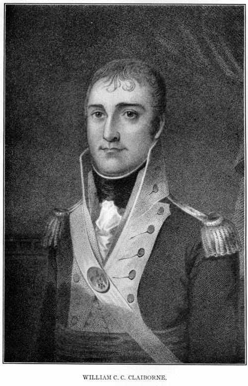
governor's laws. Sargent had already left for Boston, and the popular W.
C. C. Claiborne, of Tennessee, was appointed in his place by the new
president, Mr. Jefferson. Cotton receipts had long been the circulating
medium, and legislation now provided for money and a bank, and amongst
other things for an active militia.
It was almost as if an
armed host had been camped in the country. The whole territory was divided
up into military beats, and the lower officers were elected just as were
the members of the legislature. The beats became the unit for civil as
well as for military purposes, and the whole Southwest received a military
cast. Of the same nature was the patrol, who kept a sharp oversight over
the slaves, visited their quarters and rendered summary justice.
A digest of laws was
compiled and published in 1807, the foundation of the civil system of
future states. Its compiler was Harry Toulmin, an English Unitarian
minister, who had left England for America. Mr. Jefferson found him a
school teacher, made him president of the Transylvania University, and in
1804 appointed him Judge of the Superior Court of the Washington district
on the Tombigbee.
Influence of Louisiana
Purchase.
A turning point in the
history of the Southwest was the purchase of Louisiana by Jefferson in
1803. Mississippi territory lost its governor, for Claiborne was promoted
to the head of the new territory of Orleans, and the United States not
only acquired the undisputed right of navigating the Mississippi, but now
owned the mouth of the river itself. Mississippi territory on one side,
however, still remained on the frontier, for its faced Spanish West
Florida. It is true Louisiana was always claimed by the United States to
extend as far eastward as the Perdido River, but a hint from Napoleon for
some time restrained the Federal authorities from undertaking to enforce
the claim.
The whole West, however,
was undergoing transformation. Indiana had been made a separate territory
in 1801, Ohio admitted as a state the next year, and Illinois territory
was soon to be separated from Indiana. Conditions gradually changed both
in Europe and America.
Spanish Possessions and
Aaron Burr.
There came to be an intense
desire in the West to expel the Spanish from Baton Rouge and Mobile on the
one side, and to make good the United States claim out to the Sabine on
the other. At the same time the Mexican authorities prepared to assert the
Spanish claim eastward to the Arroya Hondo and send an army forward to
maintain it, while General Wilkinson marched to oppose occupation. War
seemed imminent.
Then entered a new factor.
Aaron Burr, after ceasing to be Vice-President, took advantage of his
personal popularity to organize an expedition which, he said, was to
occupy a Spanish grant which he had purchased. Jefferson was hostile to
him and set in motion the whole governmental machinery to prove that he
had treasonable designs. He was arrested in Kentucky, defended by Henry
Clay, and released. He went down the Ohio and Mississippi, but rumors
preceded him. Wilkinson, whom he claimed at one time as one of his
friends, now concluded a truce with the Spanish general, by which the
disputed territory was left neutral ground, and marched for New Orleans
and Natchez. Cowles Mead, acting as governor of Mississippi territory in
the absence of Governor Williams, called out the militia, and feverish
anxiety prevailed.
Burr arrived near Natchez,
anchored on the Spanish side of the river, and, when interviewed, quietly
surrendered to the civil authorities. District-Attorney Poindexter
attempted, unsuccessfully, to have him indicted by the grand jury under
the direction of the Territorial Supreme Court, which had no Federal
jurisdiction. It declined to release Burr from his recognizance, however,
and the next morning he was not to be found.
A few days later Burr was
arrested near the lower Tombigbee and kept in easy confinement at Fort
Stoddert for some time, charming everyone who met him. Such was his
magnetism that Captain Gaines found it expedient to send him under a
picked guard across Mims Ferry and through the states to Richmond for
trial. There he was acquitted, Chief Justice Marshall presiding; but his
plans had received such a blow that he never returned to the Southwest,
even to claim a beautiful woman whom he had fascinated near Natchez.
The Spanish rule below the
line was mild, but blood proved thicker than water. The brothers Kemper
had made raids upon Spanish possessions, and had been badly treated in
return. In 1810 they had their opportunity again, and with other daring
spirits raised at Baton Rouge the standard of the independent State of
West Florida. The Spaniards retired to Mobile and Pensacola, the new flag
was unfurled at Biloxi and Pascagoula, and Kemper roused the Washington
district to raise an army of invasion. Whiskey and dissension, however,
ruined the project, and a Spanish force from Mobile captured the invaders
on the way.
The United States, while
disavowing the acts of the Kempers, nevertheless, through Governor
Claiborne, of Louisiana, took possession of the pseudo state. As time went
on they felt emboldened to go further, and General Wilkinson, in April,
1813, "without the effusion of a drop of blood," compelled the surrender
of Mobile. Ultimately the territorial acquisitions were divided between
Louisiana and Mississippi territory, which thus reached the Gulf.
War of 1812.
Meantime war had commenced
with Great Britain and, as Pensacola was used as a base by the British
fleet in the Gulf, the whole coast was threatened. An even more pressing
danger, however, arose in the interior, when Tecumseh, supposed to be
inspired from Canada, came to arouse the southern Indians, who held still
three-quarters of the nominal bounds of Mississippi territory.
The Choctaws were kept in
alliance with the Americans by the exertions of Pushmataha, and the alarm
felt even in the Natchez district was gradually allayed. Tecumseh had been
fully successful in his visit to the Creeks, however, and what Colonel
Hawkins, the Indian agent, at first thought would be an Indian civil
struggle developed into the Creek War, which, in 1814, laid waste Fort
Mims and the settlements between the Alabama and Tombigbee. This was a
long way from the seat of Federal government, but the militia of Georgia,
Tennessee and Mississippi territory were called into service. The
Mississippi volunteers under Gen. F. L. Claiborne marched over to Mt.
Vernon near Fort Stoddert, and finally built Fort Claiborne on the Alabama
and burned the Creek stronghold of Econochaca or Holy Ground. Floyd did
not advance far with the Georgia troops, but the indomitable Jackson
pressed southward from Tennessee, winning such battles as Talladega and
Horse Shoe Bend. He camped, finally, at old Fort Toulouse, then renamed
for him, in the fork of the Coosa and Tallapoosa, whence, after dictating
peace, he floated down the Alabama to Mobile.

Soon England and the United
States arranged a peace at Ghent, and the development of the Southwest was
renewed. The Creek War had devastated the eastern portion of Mississippi
territory, but had resulted in opening to white settlement all the country
west of the Coosa and south to the Gulf. The Natchez district had not
suffered, and it also grew by leaps and bounds.
Industrial Progress.
The Latins had brought
cattle and the horse to America, with the result that agriculture not only
furnished food, but tobacco, indigo and cotton for export. Whitney's
invention of a gin which, by cylinder and teeth eliminated the seed,
reached the Southwest in the time of the Spaniards, and in the first years
of the new territory it revolutionized industry. More cotton was planted,
more immigrants came, more slaves were imported. Plantation life
established an extensive rather than intensive type of civilization, and
the Southwest contrasted even more sharply with the North than did the
rest of the South. Transportation, however, was difficult, and in
consequence there was little incentive to raise a surplus for exchange
abroad. Roads were rude because the population was sparse in this rural
territory, and boats slow and uncertain.
In 1811 war was threatening
and nature was in convulsion. Earthquakes engulfed New Madrid on the upper
Mississippi and the end of the world seemed near, when there came a happy
portent meaning much for the future.
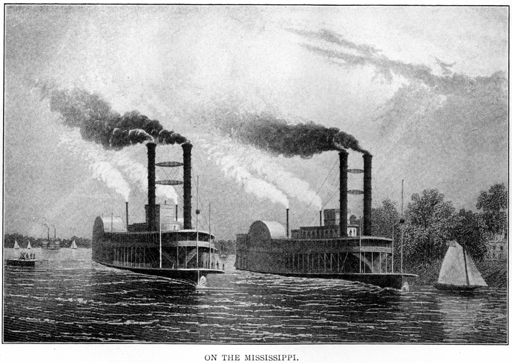
After Fulton invented his
steamboat and operated it on the Hudson River, his agent, N. J. Roosevelt,
carefully explored the Ohio and Mississippi with a view of introducing the
invention. Failure was predicted on account of the strong currents, but he
built at Pittsburgh the steamer New Orleans and gradually descended the
rivers. The whole population of the little towns of Cincinnati and
Louisville turned out to see the wonder, and she carried cotton down from
Natchez. The transportation problem was solved. A new step had been taken
in civilization.
We have not been able to
trace the evolution of a commonwealth up from the Stone Age, for the
Indians were gradually retreating before the white men. We study its
history only from the time of the settlement of the civilized races, and
can now see that with the American territory growing from the nuclei at
Natchez and on the Mobile, the advance in the inventions and institutions
of civilization was more marked than at any time before.
Religious and Social
Conditions.
The incomers brought the
Protestant religion, with its individualism as well as its fear of God.
The Congregationalists had come even in Spanish times, but the new
denomination called Methodists and the other pioneer sect of Baptists
followed close behind and became dominant. The eccentric Lorenzo Dow, at
the beginning of the Nineteenth century, found all three faiths in active
operation, although to his notions there was sometimes little success to
their efforts.
If religious institutions
had taken a strong hold, political were even more prominent. The
necessities of the case made the community a military democracy,
self-governing as far as the Federal policy permitted, and anxious for the
fuller autonomy of statehood. Taxation was rather coveted than avoided,
for it gave the people public buildings, roads and laws.
The social institutions
were sui generis. The adaptation of the soil to agriculture, particularly
to cotton, and the resulting importation of negro slaves led to the
plantation life and created a special form of society, having aristocratic
and patriarchal elements with all its democracy. How far the prevailing
Jeffersonian tendency to liberty, equality and fraternity would affect
this social organism remained to be seen.
Institutions are not the
only milestones of human progress. They mark the intellectual side, but
inventions come even earlier and are the basis upon which institutions
rest. The inhabitants of Mississippi territory inherited all that had been
used by Europeans and Americans, and were now to find in the new cotton
gin and steamboat the cause and means of upbuilding an agricultural
commonwealth unique in history.
State Formed 1817.
The old Southwest was a
geographical unit in that it drained to the Gulf, but when the steamboat
emphasized waterways there was a cleavage of interests. Previous plans for
one great state, or for two states running east and west, gave way before
the new conditions. The river steamer called for the division line to run
north and south, practically on the line between the Mississippi and
Tombigbee basins, and thus, in 1817, came into being the State of
Mississippi, formed of the western half of the old Territory.
BIBLIOGRAPHY.- I, GENERAL:
Winsor, Justin: Narrative and Critical History (8 vols., 1887),
Mississippi Basin (1895), Transactions Mississippi Historical Society: Ogg,
F. A.: Opening of the Mississippi (1904) Hamilton, P. J.: Colonization of
South (1904, History of N. A. Series); Colonial Mobile (1897); Monette, J.
W.: Valley of Mississippi, 1848).
II. INDIAN: Gatschet, Creek Migration Legend; American State Papers,
Indian Relations (1832, Vols. I. and II.).
III. SPANISH: Documents.-Maps, etc., at Seville; American State Papers,
Public Lands (Vols. I.-VI.); White: New Recopilacion (Vols. I. and II.).
Travels-De Soto: Garcilasso, Gentleman of Elvas (Spanish Explorers, 1907),
Biedma, Ranjel (in Trail Maker Series); TernauxCompans: Recueil Floride;
Collot Atlas; Cabeza de Vaca (Spanish Explorers, 1907). Histories-Scaife,
W. B.: America Geographical History (1892); Barcia: Ensayo Cronologico
(1723); Lowery, W.: Spanish Settlements in U. S. (1901); Ruidiaz: Florida
(1893, 2 vols.).
IV. FRENCH: Documents. Maps in Howard Library, New Orleans; Mss. by Margry
at New Orleans; Mss. by Magne at New Orleans; Parochial Records of Mobile,
New Orleans, and Natchez; B. F. French: Historical Collections Louisiana
(Vol. I.-V.), Historical Collections Louisiana and Florida (Vols. I.-II);
Margry: Decouvertes (Vols. I.-VI.); Cusachs Mss., New Orleans. Travels-La
Harpe, B.: Journal Historique (1831); Penicaut, in 6th French and 5th
Margry; Charlevoix: Histoire de la Nouv. France, etc. (1744); Le Page du
Pratz: Histoire de la Louisiane; Dumont: Memoires Historiques (6 French);
Bossu: Nouvaux Voyages: Kip's Early Jesuit Missions. Histories-Gayarre:
Louisiana (4 vols.); Martin: Louisiana; Fortier: Louisiana (1904, 4
vols.); King's Bienville (1892); Shea, J. G.: Early Voyages on
Mississippi, Catholic Missions (1854); Catholic Church in Colonial Days.
V. BRITISH: Documents-Haldimand Papers (Ottawa). Travels - Adair's
American Indians (1775): Pitman, Ph.: Mississippi Settlements (reprint,
1906); Romans: Florida, Jeffrey: French Dominion; Roberts: Florida;
Bartram, Wm.: Travels North Carolina, etc. (1793). Histories -Campbell, R.
L.: Colonial Florida (1892).
VI. AMERICAN: Documents.-Draper Mss. (Madison, Wis.); Ellicott's Journal,
Laws of Mississippi Territory, Judges: Laws of Mississippi Territory,
Toulmin, Latour: War in West Florida (1816); Deed Books of Mobile and
other counties. Histories.-Claiborne, J. F. H.: Mississippi as Colony,
Territory, etc.: Meek, A. B.: Romance o f Southwestern History (1857);
Ball and Halbert: Creek War (1895); Jones, J. G.: Protestantism in
Mississippi, etc. (1866).
PETER J. HAMILTON,
Author of Colonization of the South, Reconstruction, etc. |