The seaboard, 35 miles in
length, which Kincardineshire possesses, is perhaps as interesting as
any other part of the Scottish coast, on account not merely of its
picturesque rock scenery but also of its historical associations. All
the way paths run close to the sea, from many points in which splendid
views can be got of maritime and inland scenery, though undoubtedly we
obtain the best idea of its beauty when sailing along the coast. Like
most of the eastern seaboard of Scotland, the Kincardineshire portion is
much exposed to the strong gales sweeping in from the North Sea; and
this, combined with the rocky nature of the greater part of the shore,
accounts for many of the shipping disasters that occur.
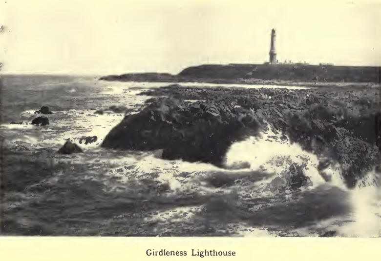
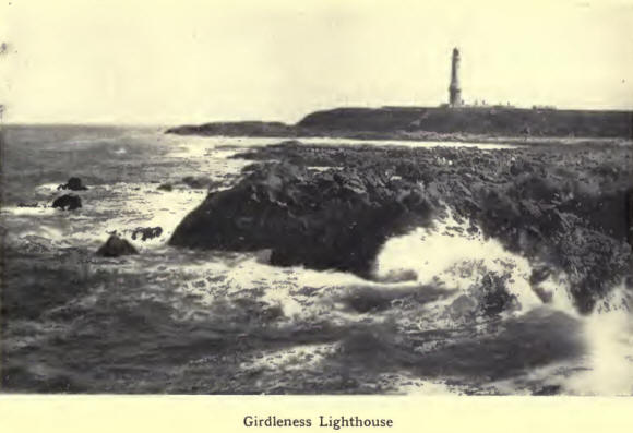
Starting our peregrination from Aberdeen we note first the Bay of Nigg,
flanked on the north by the lighthouse of Girdleness, and on the south
by Greg Ness, the circular outline of the bay being fringed by a
beautiful pebbly shore. Here, formerly, was the mouth of the Dee, which
flowed in the hollow from Craiginches. On the bay stands a fish-hatchery
with laboratory. A little inland is St Fitticks ruined church.
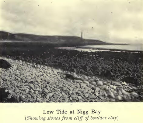
Prominent on the south of the bay is a cliff of boulder clay, the rapid
erosion of which has littered the beach with thousands of stones.
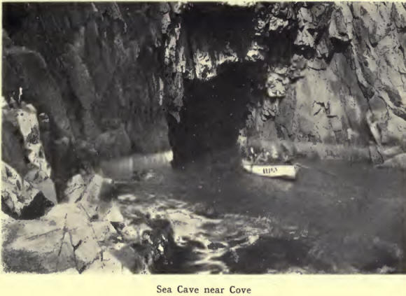
Passing on, we find the
coast bold, rocky, and picturesque ; and we reach in succession the
small fishing villages of Cove and Portlethen. Between them, but back
from the cliffs, is Findon, world-famous as the original home of the
Finnan haddock. The haddocks cured there, says Thom (History of
Aberdeen), are superior in flavour and taste to any other, which is
attributed to the nature of the turf used in smoking them. The industry
is now entirely given up in Findon. Skateraw, a little further south,
is, like the other creeks, reached by a narrow, circuitous path down the
sea slopes, up which in former days the hardy fishermen carried in their
creels the shining harvest of the sea to be transported by road or
rail to the larger centres of population. Part of the fish supplies
landed here were split and sun-dried on the stony beach, and went by the
name of speldings. Like the Finnan haddie, these, when properly
cooked, were held in high esteem. The small burn of Elsick, spanned by a
substantial railway viaduct, here enters the sea.
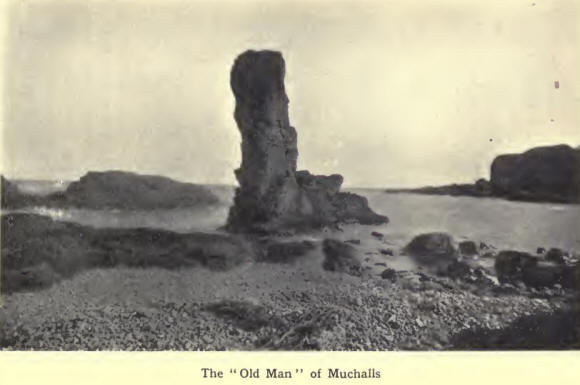
The next part of the
coast, adjacent to the neat little village of Muchalls, has received
much attention from the painter of maritime subjects, and deservedly so,
because of the artistic beauty of the rugged, weatherbeaten cliffs. Here
by the ceaseless action of the elements the softer portions of the
cliffs have been scooped out into long, deep gullies through which in
stormy mood the sea rolls with resounding and majestic grandeur. The
Fishers Shore, the Grim Brigs with its wonderful arches of Natures
own devising, the Old Man, and the Scarts Crag, around and above
which for ever breaks the crested wave, are notable points whose names,
like that of Gin Shore, a little further south, are reminiscent of the
past, and full of interest and suggestion.
Between Muchalls and
Stonehaven we pass Garron Point, on whose green summit stand the
picturesque ruins of the old chapel of Cowie. The little fishing village
of Cowie nestles below the cliffs, while above, skirting the shore, is
the Stonehaven Golf Course, from which splendid views can be had of sea
and shore.
Stonehaven Bay extends in a circular sweep from Garron Point to Downie
Point. Alongside of its pebbly beach runs a promenade, flanked on the
north by extensive recreation grounds. Its waters give ample scope for
bathing and boating, while the dull grey and brown outlines of the Old
Town dwellings at the southern end impart an old-world appearance to the
scene.
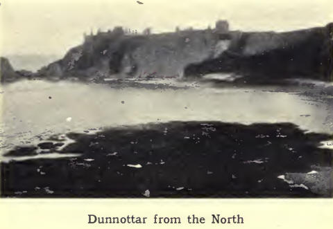
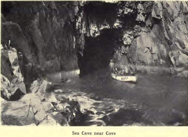
Rounding the Black Hill,
from the top of which unrolls one of the finest views of town, coast and
inland, we reach the historic castle of Dunnottar, where, as Carlyles
eulogy of the famous Marshal Keith reminds us, The hoarse sea winds and
caverns sing vague requiems to his honourable line and him. Here the
panorama formed by cliffs and bay is magnificentthe former almost 170
ft. high with cathedral-like arches, the latter with gloomy creeks and
caverns. The very names, as Brun Cheek, Maiden Ivaim, Long
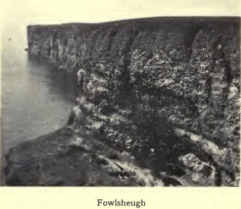
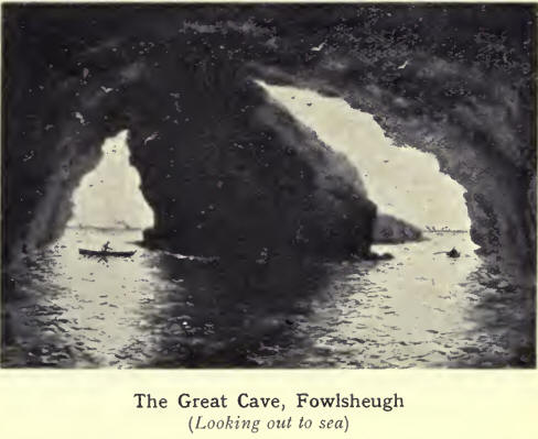
Gallery, Wine Cove, testify to Natures handiwork and skill. South of
Trelung Ness we reach the highest of the rocks, the cliffs of Fowlsheugh,
the noted nursery for sea birds, extending over a mile. The birds make
their nests in the crevices of the conglomerate rock, out of which by
constant weathering pebbles have been forced, affording a natural
nesting-place. The spectacle of the myriads of birds in early summer, on
the dreadful summit of the cliff That beetles oer his base into the
sea, is most interesting and instructive, and will well repay a visit
from others than bird-lovers.
Between Fowlsheugh Point
and Bervie Bay the cliffs are still bold and precipitous, with generally
no beach between their base and the deep .water. Todhead lighthouse
stands on a prominent headland at the southern extremity of Braidon Bay,
a little beyond the old fashioned fishing village of Catterline. Craig
David, a few miles further south, overlooking Bervie Bay, marks the
terminus of the high cliffs which form the naturalwall of protection to
most of the Kincardineshire coast.
From this point onwards the configuration of the coast-line is entirely
different. The beach is now low, pebble-strewn, and gravelly, with low,
shelving rocks jutting out to the sea. Gourdondominated by Gourdon
Hill, a noted landmark for seamenand Johnshaven have both small
harbours, their appearance from above being quaint and picturesque. A
little further south is the hamlet of Milton of Mathers. Rounding a bend
in the coast we pass the Ivaim of Mathers, and reach St Cyrus braes,
varying in height from 50 to 300 ft. On the summit stands conspicuous
the parish church with its lofty spire. Passing over a flat beach of
fine sand bound together by sea grasses and other marine plants, we end
our perambulation of the coast at the mouth of the North Esk.
The coast-line of the
county bears witness to the gigantic power of marine erosion. Cliffs and
bays, caves and half-tide stacks, show that the action of the sea in
sculpturing coastal scenery is everywhere guided by rock-composition and
structure. In this connection we may quote the words of Sir Charles
Lyell with regard to a case of historic interest. On the coast » of
Kincardineshire an. illustration was afforded, at the close of last
century [the eighteenth], of the effect of promontories in protecting a
line of low-shore. The village of Mathers, two miles south of Johnshaven,
was built on an ancient shingle beach, protected by a projecting ledge
of limestone rock. This was quarried for lime to such an extent that the
sea broke through, and in 1795 carried away the whole village in one
night, and penetrated 150 yards inland, where it has maintained its
ground ever since, the new village having been built further inland on
the new shore.
In late glacial and
post-glacial times there took place alterations in the relative level of
land and sea. The raised beaches of the coast and the alluvial tracts of
the river valleys were formed when the land stood relatively lower than
at present. Two sets of beaches are clearly marked in Kincardineshire.
Both are well seen at Stonehaven, the newer part of which is built on
the flat of the 100-ft. beach, the older on the 25-ft. beach. The lower
beach shows its best development southwards from Bervie, the old
sea-cliff forming a strong feature all the way to the mouth of the North
Esk, and the flat rocky foreshore of the present sea margin offering a
striking contrast to the frowning cliffs which bound the shore from
Bervie to Stonehaven harbour. That the land at one period stood, higher
(or the sea lower) than at present is shown by the occurrence of a
buried forest beneath the 25-ft. beach.
|