There is a steadily growing network of longer
walking trails developing across Scotland. The three 'official' trails, the West Highland
Way, Southern Upland Way and Speyside Way, have been in operation for some time. These
trails attract support for their ongoing maintenance from Scottish Natural Heritage and
all three are marked by the national symbol of a thistle inside a hexagon. Further trails
are being developed by local authorities, often in partnership with other bodies. Details
of all know trails are given below. Long distance trails are carefully prepared to provide
the best possible walking experience together with sufficient places for accommodation and
supplies. All those listed below are suitable for 'sampling' in part if you do not wish to
commit yourself to the full trail, and most have good supporting literature. In addition,
Area Tourist Boards and local Tourist Information Centres are always happy to help with
accommodation or other general enquiries.
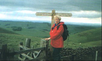
The West Highland
Way
Milngavie (just north of Glasgow) to Fort William. 150km/95 miles
The West Highland Way, opened in 1980, is the busiest of Scotland's longer trails
at present. The route holds great appeal, progressing steadily from the lowlands of the
Central Belt to the highlands, and many walkers finish it off with an ascent of Ben Nevis,
Britain's highest mountain at 4,406ft (1,344m). Highlights include the eastern shore of
Loch Lomond, and the traverse of the western edge of Rannoch Moor to enter Glencoe at
White Corries, with a magnificent view of Buachaille Etive Mor.
Further Information: Trail leaflet including
accommodation and facilities guide from West Highland Way Ranger Service, Balloch Castle,
Balloch, Dunbartonshire G53 8LX Tel: 01389 758216 Fax: 01389 755721. Click here for further
information and also
http://www.west-highland-way.co.uk/
The Southern
Upland Way
Portpatrick to Cockburnspath. 340km/212 miles
This route runs from Portpatrick on the west coast of Scotland, not far from
Stranraer, to Cockburnspath on the Berwickshire coast south of Dunbar. The route passes
through a great variety of scenery and reaches its high point at over 700m on Lowther Hill
above Wanlockhead. It is a demanding and strenuous route, crossing the grain of the land
for much of the way. Highlights include Glen Trool, Wanlockhead (Scotland's highest
village), St Mary's Loch and the ancient track over Minch Moor past the tall Three
Brethern cairns.
Further Information: descriptive leaflet and separate
free accommodation guide from Countryside Ranger Services, Scottish Borders Council,
Harestanes Visitor Centre, Ancrum, Jedburgh TD8 6UQ Tel/Fax: 01835 830281. Click here for an
American Guide
Speyside Way
Spey Bay to Aviemore. 116km/75 miles
The Speyside Way, one of four official
long distance trails in Scotland, first opened in 1981. Originally the trail
ran from Ballindalloch to Spey Bay but in 1990 it was extended by adding a
section to Tomintoul. In April 2000 a further extension was opened from
Aviemore to Ballindalloch, giving hikers a choice of where to start/finish.
Further Information: route leaflets from Moray Council
Ranger Service, Boat of Fiddich, Craigellachie, Aberlour AB38 9RQ Tel: 01340 881226
http://www.moray.org/area/speyway/webpages/swhome.htm
St Cuthbert's Way
Melrose to Lindisfarne. 100km/62 miles
A cross-Border trail, this walk links several places associated with St Cuthbert,
who started his ministry at Melrose in the mid 7th century and ended it at Loindisfarne,
the Holy Island of the Northumberland coast. The route is waymarked with the symbol of St
Cuthberts Cross. The walk starts at the superb ruin of Melrose Abbey and climbs to cross
the Eildon Hills, before joining the River Tweed. Other highlights include the Roman Road
Dere Street, the Cheviot foothills, St Cuthbert's Cave and the causeway crossing to
Lindisfarne.
Further Information: free route leaflets and
accommodation / facilities guide from Scottish Borders Council, Harestanes Visitor Centre,
Ancrum, Jedburgh TD8 6UQ Tel/Fax: 01835 830281.
The Clyde Walkway
Considerable work has been carried out on this route, which will eventually run
from Bonnington Mill, above New Lanark, into the heart of Glasgow, following the River
Clyde as closely as possible. Most of the stretch from Bothwell Castle through Glasgow is complete from New Lanark to
Crossford. It links with two shorter routes developed by the City of Glasgow Council, the
Kelvin Walkway and Allander Walkway, which provide an attractive route from the city
centre to the start of the West Highland Way at Milngavie.
Further Information: leaflets on the Kelvin and Allander
Walkways are available from the Greater Glasgow and Clyde Valley Tourist Board, 11 George
Square, Glasgow G2 1DT Tel: 0141 204 4400 Fax: 0141 221 3524. Clyde Walkway leaflet from
South Lanarkshire Council, Leisure & Recreation Department, 307 Quarry Street,
Hamilton ML3 6QD
Fife Coastal Path
This route will eventually join the two great bridges, running for about 100km/60
miles from North Queensferry at the foot of the Forth Bridge to the Tay Bridge at Dundee.
It is still under development but is complete from North Queensferry to Pittenweem (62km39 miles).
Further Information: six leaflets covering the open
section are available from the Tourist Information Centre, 19 Whytescauseway, Kirkcaldy
KY1 1XF Tel: 01592 267775.
The Pilgrims Way
Glenluce to Whithorn. 40km/25 miles
This route, developed by the Whithorn Pilgrimage Trust, follows tracks and quiet
roads from the ancient abbey in Glenluce southwards to Whithorn, where St Ninian began his
task of preaching Christianity to the Scots. It is waymarked with a Celtic cross symbol.
The Canals
Although not formal long distance paths, the canals passing through the Central
Belt provide attractive and quiet walking. The Union Canal can be followed for most of its
length from Edinburgh to its terminus at Falkirk, a length of about 48km/30 miles. a short
distance from here, the Forth & Clyde Canal can be joined and walked down to the Clyde
at Bowling, adding a further 55km/34 miles.
Further Information: canal leaflets are available locally
at Tourist Information Centres.
The Formartine and
Buchan Way
Dyce to Peterhead. 61km/38 miles
This walking and cycling route has been developed by local authorities in
Aberdeenshire, following old railway lines. It starts at Dyce Station, north-west of
Aberdeen, and passes through or near Udny, Ellon, Langside, Maud and Mintlaw before
arriving at the busy port of Peterhead.
Further Information: route leaflet from Countryside
Access Officer, Aberdeenshire Council, Gordon House, Blackhall Road, Inverurie AB51 3WE.
Rob Roy Way
Drymen to Pitlochry 127km/79 miles or 148km/92 miles
A seven day walk across the Southern
Highland of Scotland taking in some of the most beautiful countryside in the
UK. Starting from Drymen on the West Highland Way it goes north east to
finish in Pitlochry. See
http://www.robroyway.fsnet.co.uk/
|

