|
Lying south of the Red Deer River valley and
between the Cypress Hills and the Rocky Mountains, is an expanse of
territory relatively dry and suitable for irrigation. In its natural
state the territory is admirably adapted for grazing and though the
rainfall is sufficient in some years to produce splendid cereal crops,
the recurrence of dry years is so frequent that irrigation is necessary
to sustain successful agriculture.
In the early days of the province it was the great ranching district of
the North West Territories, but owing to the demand for land following
the construction of the C. P. R. in 1884 the grazing regulations whereby
large areas were leased to stock growers were cancelled and the district
opened for homesteading. The cancellation of the grazing regulations
went into effect in 1893 and active settlement began. With settlement
the movement for irrigation arose. The father of the movement may be
said to have been Mr. William Pearce of Calgary, for several years
Superintendent of Mines under the Department of the Interior.
The first irrigation ditch in the North
West Territories was constructed by Mr. John Glenn who in 1875 squatted
on what upon survey proved to be section 3, township 23, range 1, west
5th meridian. The ditch was constructed about 1878. The water was taken
out of Fish Creek and an area of 15 to 20 acres irrigated. Next, two
Americans who squatted on the Peigan Indian Reserve before it was
surveyed. tapped Beaver Creek so as to convey water to a small portion
of land whenever the creek overflowed. In 1889, water was taken out of
Big Bear Creek which lies on the north slope of the Cypress Hills and
enters into Crane Lake, by ditch, to create more hay lands. The next
ditch constructed in the territory is supposed to have been in the year
1891 by Mr. John Quirk. The water was taken out of the north fork of
Sheep Creek about section 5, township 20, range 4, west 5th. This was
one of the most successful of the early ditches.
The first Irrigation Company chartered by
Act of Parliament of Canada was organized in 1891 when the Macleod
Irrigation Company received its charter. In 1892 the high River and
Sheep Creek Irrigation Company was incorporated and in the same year the
Alberta Railway and Coal Company received authority to construct
irrigation works under their charter. In 1893 charters were granted to
the Alberta Irrigation Company, the Calgary Hydraulic Company and the
Calgary Irrigation Company. When the Northwest Irrigation Act was passed
in 1894 the necessity for private charters for irrigation companies
ceased.
For a time the Government of Canada did
not favour irrigation for fear of creating a bad impression abroad
respecting the North West Territories as a field for settlement. But the
proportion of the North-West requiring irrigation was so small in
comparison with the total area of the territories that such an
apprehension was unwarrantable. The area comprises less than 50 million
acres and is watered by nine large rivers besides many small
tributaries. At the southwestern corner of the area is a large natural
reservoir, the Waterton Lakes, available to augment the water supply for
an immense district. In due course the Government found that irrigation
lands had become a factor in attracting settlers to Southern Alberta as
much as the lands in the so-called fertile belt north of the Red Deer
River and in the valley of the North Saskatchewan.
A large portion of the territory had been
granted to railways. The Canadian Pacific Railway Company held every
odd-numbered section within the railway belt. That was a strip of land
extending twenty-four miles on each side of the main line of the
railway. One of the conditions of the grant of land to the C. P. R. by
the contract of 1881 was that the land comprised in the railway belt
should be fit for settlement. In order to make such lands lit for
settlement, irrigation was necessary. The Company, however, could not
irrigate its own lands without benefiting the even numbered sections. It
therefore applied to Parliament to have the original contract altered
respecting the lands in the railway belt and to have lands conveyed en
bloc. The area surveyed comprised about 4,952,000 acres, of which
250,000 acres belonged to the Hudson's Bay Company by the deed of
surrender of 1870 and 275,000 acres were school lands. Accordingly an
Act was passed by the Dominion Parliament in 1894 authorizing the land
subsidy in the railway belt from Medicine Hat to Crowfoot Crossing to be
granted wholly or in part in solid tracts in such area as agreed upon
between the Government and the Company. The Act did not affect the
Hudson's Bay Company land unless the Hudson's Bay Company consented, nor
did it affect school lands unless other public lands should be set apart
in lieu thereof.

The next step in the development of
irrigation was the passing of the Northwest Irrigation Act in 1894
(57-58 Victoria c. 30). By this Act the right to the use of all water
for any purpose became vested in the Crown. Although it is called an
Irrigation Act, it is more properly called a water users' act. Water for
domestic, irrigation, industrial, municipal and other purposes as well
as stream measurements, survey of storage reservoirs, inspection of
works for the use of water, construction of drainage work and the
granting of all licenses for the use of water, are administered under
this Act. In order to determine the quantity of water in the streams and
exercise intelligent control over its distribution, an elaborate system
of topographical and hydrographic surveys were begun in 1894 under J. S.
Dennis, C. E., and in May, 1895, an irrigation office was opened in
Calgary.
For a time the survey work was carried on
under the direct supervision of the Minister of the Interior, but in
1902 an arrangement was made with the government of the North West
Territories whereby irrigation surveys were conducted through the
Commissioner of Public Works for the North West Territories, and the
report thereon made to the Department of the Interior. This arrangement
terminated when the Province of Alberta was organized. Irrigation
surveys have been carried on ever since with more or less energy. At the
present time the Government and the big irrigation companies have a
great fund of data on the possibilities of irrigation farming in the
semi-arid districts.
For a number of years after the passing
of the North West Irrigation Act, there were a great many small
irrigation works undertaken to supply water to individual holdings, as
well as several larger works designed to irrigate an extensive acreage.
Among the latter the most important were the Calgary Irrigation Company
45,000 acres; Springbank Irrigation Canal west of Calgary 40,000 acres;
R. A. Wallace ditch at High River 2,600 acres; Findley & McDougall ditch
at High River, 2,600 acres; Robertson ditch at high River 1,265 acres;
New Oxley Ranch ditch, Standoff, 1,850 acres; W. R. Hull ditch at Fish
Creek, 1,300 acres. At the end of 1885 there were 112 ditches with a
capacity of irrigating 79,270 acres in the province. In 1898 the number
increased to 177 ditches irrigating 103,464 acres. By 1903 the number of
canals and ditches was 163 with a mileage of 480 miles irrigating
623,362 acres.
The year 1901, 1902 and 1903 were vet
years and interest in irrigation by small holders declined. From that
time the development of irrigation schemes has been almost entirely
carried on by the Canadian Pacific Railway Company and large
corporations like the Alberta Railway and Irrigation Company and the
Southern Alberta Land Company.
One of the first undertakings of the
Government in connection with irrigation surveys, was to determine the
feasibility of utilizing the waters of the larger streams for the
irrigation of large tracts of land. Preliminary surveys were made in
1896 to locate a canal to convey the waters of the St. Mary River to the
Lethbridge Plains. Similar surveys were made along the Bow River east of
Calgary in the Canadian Pacific Railway Irrigation Block. The first of
these Projects was developed by the Alberta Irrigation Company
subsequently known as the Canadian Northwest Irrigation and later as the
Alberta Railway and Irrigation Company and now controlled by the
Canadian Pacific Railway Company. Authority for the construction of
works was granted in 1898. The detailed surveys were carried out by Mr.
George G. Anderson, C. E., who has been prominently identified with
irrigation surveys in Alberta ever since and is now consulting engineer
of the Alberta Government in connection with its policy of guarantee of
irrigation bonds. The water was turned into the canal in September,
1900. As a result the towns of Magrath, Raymond and Stirling sprang into
existence and settlers flocked into the district. In 1900 separate
authorization was issued for the construction of works to utilize water
from different sources of supply in this region. These works were merged
in October, 1902, and amplified to utilize the water from the St. Mary
and Milk rivers for the irrigation of the irrigable portion of 500,000
acres. A period of fifteen years was granted for the construction of the
necessary works. Development proceeded as settlement warranted and by
the end of 1915 the Company had constructed 200 miles of main and
secondary canals, not including farm laterals. The capacity of the main
canals was 1,000 second-feet; the cost of the works was approximately
$1,368,000; the irrigable area approximately 130,000 acres, of which
75,000 were actually Put under irrigation. By 1918 practically the whole
of the irrigable land was disposed of to settlers and the canal mileage
increased to 230 miles. Further development depends upon obtaining
increased water supply. The possibility of obtaining more water depends
upon the issue of the International Joint Commission as to the division
of the waters of the St. Mary and Milk rivers between the State of
Montana and Southern Alberta.
The second of the large projects
investigated by Government engineers, demonstrated the feasibility of
utilizing the water from the Bow River for the irrigation of a large
tract of land extending eastward from Calgary along the main line of the
C. P. R. By the Canadian Pacific Railway charter of 1881 the Company was
entitled to a grant of 25 million acres to be selected in alternate
sections within the railway belt. The company had the right to reject
any lands not fairly fit for settlement and had refused to accept as
part of its grant, any lands in the region between Moose Jaw and the
Rocky Mountains, that is, in the dry belt. Sections in lieu of the land
rejected were made in other parts of the province, but at the time of
the final settlement in 1903 there was a balance due to the Company of
three million acres, which it agreed to take in the dry belt along the
main line in Alberta, if it were allowed to take it en bloc. Accordingly
the Act referred to previously in this Chapter was passed and the
agreement confirmed. The company followed up the surveys conducted by
the Government with a view to the construction of irrigation works, and
applied for water rights. The block of land concerned was about 125
miles long and 50 miles wide tributary to the Bow River. For convenience
of administration the Company divided this immense block into three
sections, the western, the central and the eastern of approximately
equal area.
The western section was developed first.
Authority for the construction of the works was issued April 20, 1904,
to be completed within a period of fifteen years. A canal was
constructed that heads into the Bow River near Calgary and traverses a
tract of 600,000 acres of which 223,000 acres are irrigable. The
westerly limit of the irrigable land in this section is about ten miles
east of Calgary and extends about 45 miles farther east. The main canal
is 16 miles with secondary canals and laterals comprising a total length
of 2,480 miles. The capacity of the main canal is 2,260 second-feet. The
total cost of the works was about $4,827,000; the number of users 753
and the water rental 50 cents per irrigable acre. The works in this
section were completed in 1911 and in August of that year the Company
applied to the Government to make the inspection required by law.
Active settlement in this section began
in 1908. Dissatisfaction on the part of some of the settlers induced the
government to reclassify the land. The work of inspection began in 1913
and was completed in 1915. The net result of these surveys and
reclassification was to reduce the irrigable area by 30 per cent. In
conjunction with these investigations the government also reported on
the climatic conditions, the temperature of the water in the irrigation
canals and the suitability of the soil to stand irrigation. It was
supposed the water was too cold to stimulate rapid normal growth, and
that the soil was impregnated with alkali, which would rise to the
surface when put under irrigation. The findings of the Government
experts was most satisfactory. It was found the water in the ditch was
warmer than rain water and that the occurrence of alkali was not
frequent and was confined to small areas. It was established that
irrigation may be as successfully pursued in Southern Alberta as
anywhere else oil continent.
Before the completion of the works in the
western section the Canadian Pacific Railway Company commenced the
development of the eastern section. The first step was to raise the
level of the Bow River to obtain a head for the main canal. This was
done by the construction of an immense dam at a point in the Bow River
known as "Horse Shoe Bend" about three miles south of the Town of
Bassano. The works consist of a concrete spillway (lam of the Ambursen
type, 720 feet long, to which is joined all embankment 780 feet long by
which the level of the river is raised 50 feet. Water is delivered
through five steel sluice gates into the main canal and thence by an
elaborate system of sub-canals, reservoirs and flumes and is distributed
throughout the irrigable tract. There are 2,500 miles of canals and a
reservoir with a capacity of 186,000 acre-feet. The cost of these works
was about 10 million dollars. The water was turned into the main canal
April 21, 1914.
The third large project in the scheme of
irrigation mapped out by the initial government survey, was the works
constructed by the Southern Alberta Land Company. This was a company
formed to take over a tract of land of 280,573 acres vest of Medicine
Hat, sold in 1906 to the Robins Irrigation Company of London, England. A
condition of the sale was that the company should irrigate at least 25
per cent of the land. The water is taken from the Bow River at a point
thirty miles from Calgary (tp. 21, rge. 5). A diversion weir and head
gates were constructed at this point in 1919. The level of the river was
raised five feet. The canal from the river runs along the Blackfoot
Reserve and southward into Snake Valley for a distance of 44 miles to a
Reservoir known as "Lake McGregor"—so-called after J. D. McGregor, one
of the principal shareholders of the Southern Alberta Land Company. The
capacity of this Reservoir is 360,000 acre feet or sufficient to
irrigate 180,000 acres. From Lake McGregor a canal runs easterly for 47
miles until it reaches the western boundary of the tract to be
irrigated. From this point onward the canal is tapped by sub-canals. The
main canal is carried across the Bow River by a syphon and fifteen miles
farther east another reservoir has been provided and a canal system
constructed for the land in the Suffield district. The scheme when
completed will have water to supply 200,000 acres and is estimated to
cost $10,000,000.
As already pointed out, irrigation by
individuals was never successful and it was realized very early in the
settlement of Southern Alberta, that irrigation works, if not undertaken
by a strong corporation, would have to be undertaken as a municipal or
community project. As far back as 1884, the year in which the North West
Irrigation Act was passed by the Parliament of Canada, the North West
Assembly passed the Irrigation Ordinance. This was a measure to enable
settlers in any given area, which was capable of being irrigated, to
form themselves into an irrigation district. The Ordinance was amended
and consolidated in 1898 and again in 1915 and in 1920 by the
Legislative Assembly of Alberta. The main features of the original
legislation have been preserved in all these ordinances and Acts. An
irrigation district is formed after a petition signed by a majority of
the owners representing not less than half of the total area of the land
affected and a vote is taken in which two-thirds of those voting favor
formation of an irrigation district in the area concerned. The
management is placed in the hands of a Board of Trustees who are
constituted by the Act, a body corporate having power to make by-laws,
construct works in accordance with the Dominion Irrigation Act, make
assessments, raise loans and issue bonds for which the lands irrigated
are a first security. By the Act of 1920 an Irrigation Council was
created to advise the trustees of any district on the financial and
engineering problems involved. But debentures must be approved by the
Provincial Treasurer. The expenditure of the proceeds of the sales of
debentures, contracts for the construction of irrigation works and rates
of assessment must be approved by the Irrigation Council.
The first mutual or municipal undertaking
under the North West District Irrigation Ordinance was projected in 1896
by the settlers of the Springback district, a tract of country west of
Calgary lying between the Bow and the Elbow rivers. A canal 36 miles
long was planned to convey sufficient water from the Elbow River to
irrigate 21,000 acres. In addition it was proposed to construct another
canal to utilize the waters of the Jumping Pound Creek to irrigate
20,000 acres more. Only about ten miles of this system was ever
constructed. The completion of the scheme was prevented by disagreements
among the residents and a succession of wet seasons which strengthened
the opinion that irrigation was unnecessary. The wet years from 1900 to
1907 had a deterrent effect upon irrigation development, especially upon
small schemes, but the return of a cycle of dry years beginning with
1909 and 1910 re-kindled a warm interest in the subject. rllhiS point
illustrates the difficulties in promoting irrigation in a semi-arid
country like the basin of the South Saskatchewan. In wet years the
farmers see no need for irrigation and conclude the investment thereon
is wasted. As soon as the dry years recur they swing to the opposite
opinion. This was to be expected in the initial stages of settlement,
but the collection and tabulation of rainfall records over a long series
of years, gives the farmers reliable data upon which to base conclusions
as to the value of irrigation. Since 1883 such records have been kept up
by the Meteorological Service of Canada and they indicate a regular
alternation of (Ivy with wet years.
In 1908 the Dominion Government
established an Experimental Farm at Lethbridge in the semi-arid region.
Half of the farm is irrigated while upon the other half, dry farming
methods are resorted to. Accurate data kept for eleven years from 1908
to the end of 1918 has shown that the crops obtained from the irrigated
portion of the farm were increased over the dry farming portion as
follows: Wheat, 77 per cent; Oats, 53 per cent; Barley, 81 per cent;
Potatoes, 105 per cent. These results have had a great influence upon
the farmers of Southern Alberta and their attitude towards irrigation.
Under dry farming methods it was found necessary to summer fallow to
conserve the moisture of two years to get one crop. Thus twice the area
of land was required. Dry farming also limited the farmer to grain crops
and placed him at a disadvantage in growing live stock. By irrigating he
could rotate his crops continuously and be assured of an abundant crop
of timothy and alfalfa.
In 1910 the settlers in the vicinity of
Iron Springs district north of the City of Lethbridge, petitioned the
Department of the Interior for the construction of irrigation works to
pump water from the Old Man River. The proposal was found impracticable.
The Government, however, continued a survey of the district in 1913.
This survey developed the fact that several detached tracts, comprising
in all about 100,000 acres could be irrigated at a probable cost of from
$18 to $20 per acre by diversion of water from the Old Man River. The
reconnaissance of the area was completed in 1918. By that time the cost
of labour and material had risen to such a peak that the cost of
irrigation was estimated between $40 and $50 per acre. The district was
organized into irrigation districts under the Alberta District
Irrigation Act and a strong appeal was made to the Dominion and
Provincial Governments to give financial guarantees for the construction
of the necessary irrigation works. The Dominion Government refused to
advance money directly but promised to find the money at a low rate of
interest and loan the same to the Provincial Government if it desired to
undertake the construction of the works.
In 1920 the Provincial Government
undertook to guarantee bonds for the construction of irrigation works in
this district in any two years of the debenture period. The trustees of
the district were unable to sell the bonds with such a guarantee and
finally the Alberta Government warranted a full guarantee of the
irrigation bonds of this district in the Session of 1921. The success of
the scheme is now assured and active development is in progress.
In 1915 the farmers between Chin Coulee
and Taber created the Taber Irrigation District. It was the first
district to be erected under the Alberta District Irrigation Act. They
appealed to the Canadian Pacific Railway to make the surveys and
construct the works. The Company agreed and the surveys were completed
that season. Financial difficulties, however, arose because the district
comprised some 8,000 acres of irrigable school lands which could not be
pledged for the cost of irrigation. After protracted negotiations
between the Alberta and Dominion Governments, an Act was passed by the
Parliament of Canada whereby school lands in the Taber Irrigation
district could be dealt with as if they were patented lands. Thereupon
construction proceeded and the works were completed in 1920. The water
is taken from the C. P. R. Reservoir at Chin Coulee. The cost was $16.00
per acre with a water rental of 50 cents per acre at the head gates.
Other projects are in development. The
policy of the Alberta Government in guaranteeing irrigation bonds will
ensure a considerable expansion in the area under irrigation. Several
irrigation districts are formed, upon which construction will follow in
due course. They are as follows: United Irrigation District, west of
Cardston, comprising 25,000 acres; Sundial, Retlow and Lomond District,
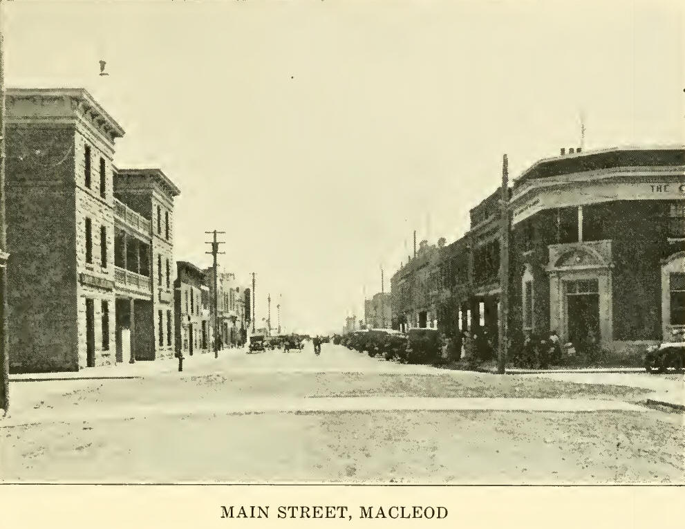
which is intended to irrigate 100,000 acres; South Macleod Irrigation
District, already formed with an irrigable area of 50,000 acres; Lone
Rock District, 8,000 acres; Medicine hat District, 15,000 acres;
Lethbridge Southeastern district, 300,000 acres.
Summing up the actual result of 20 years
of irrigation in Alberta we have the following result:
C. P. R. Lethbridge Extension, 130,000
acres, mileage of main canals, 230 miles, total cost, $2,000,000; C. P.
R. Western section, 223,226 irrigable acres, mileage of canals, 1,600
miles, cost $4,500,000; C. P. U. Eastern section irrigable area, 440,000
acres, mileage of main canals, 2,500 miles, cost $10,000,000.
Canada Land and Irrigation Co., 220,640
acres irrigable, mileage of canals, 308 miles, cost, $6,000,000; smaller
projects numbering 660, corn- prising 113,867 acres, including project
of a half section or more, cost $1,000,000. |